


Sunday, March 14, 2010
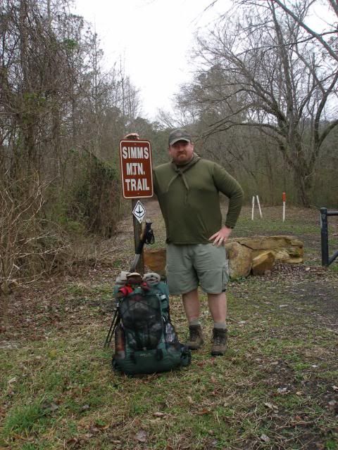
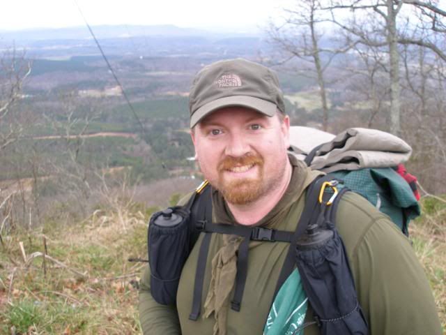
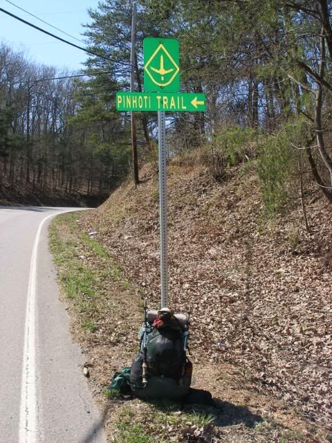
After spending Saturday scouting the 55 miles of road walk in the Cave Spring and Dalton areas, my wife dropped me off at the Simms Mountain Rail Trail Trailhead. I had expected this section to be a hard-packed gravel bed like the Virginia Creeper Trail near Damascus or perhaps even paved like the Chief Ladiga Trail on the Alabama Pinhoti. But when I got there, I discovered it was a dirt and grass bed with the railroad ties pulled away.
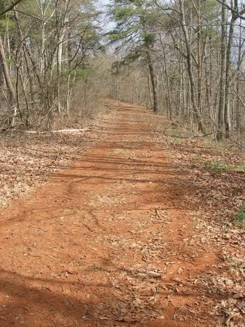
Still, despite some mud, the tread was wide and smooth and very fast. My old Marine instincts kicked in and I lowered my head and started striding along. I realized after a couple of hours I was tromping along at 3-3.5 MPH. At times, I rousted deer or turkeys. The trail often skirted next to peoples backyards, where I drew the attention of dogs, though the few that actually approached me were friendly. Other times, the corridor opened up with views.
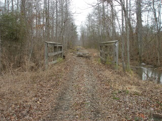
A light misty rain began to fall. This mostly just served to inspire sustained speed. Trestle bridges helped span creeks.
I was a bit disappointed at the 9 mile mark. I had planned to grab a soda at the little country store in Holland. But the store has sadly shut down. I trudged on in the chilly wind and mist. Shortly after, I walked into open farm country, the trail a divot sandwiched between a fenceline and a paved road.
As I returned to the trees, I crossed a couple of small country roads, then realized there was no sign of Pinhoti blazes. I checked my map and pocket guide and realized I had missed my turn. I was supposed to connect to a mile of GA 100 and brave the stretch so well known for logging trucks screaming along at 70+ MPH. But as I backtracked, there were no blazes at the road either. I backtracked another 150 yards and found blazes as I approached the last trestle bridge. There was a new trail carved through the woods here. I realized I was looking at a new relocation, designed to take the Pinhoti completely off the stressful GA 100.
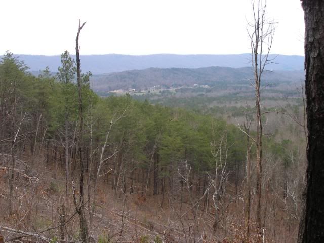
This new woods trail was a work in progress. The corridor was nicely opened of trees and brush, but the tread was untouched by a fire rake. Still the ground was mostly covered with pine needles rather than rock and the last mile of trail to High Point Trailhead was relatively fast. At a power line crossing, I got a good look at the nearby mountain known simply as High Point. Shortly after, I crossed GA 100 and arrived at the large parking area at High Point Trailhead.
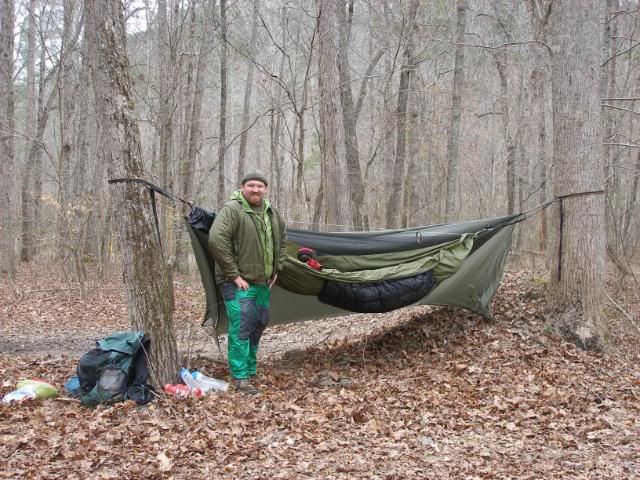
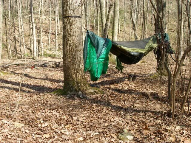
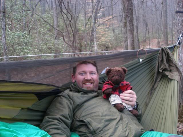
I stopped and had an early dinner at the picnic table there. Then I pushed a few hundred yards up the trail and found a stretch of open ground between two trees where I could hang my hammock on the otherwise sloping rocky ground. I settled in and got comfortable for the night.
Monday, March 15, 2010
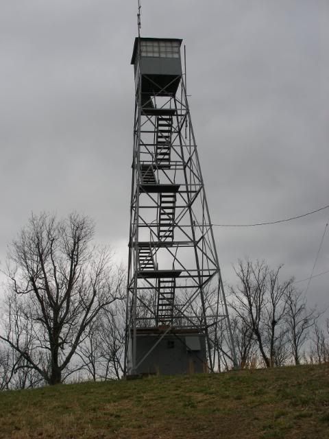
I awoke the next morning and got moving as soon as I downed my oatmeal and packed up. The day was still overcast, but was rain-free. I pushed up the winding stretch of trail on my way to High Point. I made it to the summit with surprising ease. Technically the Pinhoti Trail bypasses the summit, but a small worn path led me straight to the firetower on top.
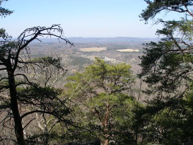
The towers lower ladder had been removed much like the Horn Mountain Tower in Alabama. However, the power line break offered excellent views.
From there, I headed down the ridge. The trail joined existing logging roads. This was typical of the first 50 or so trail miles of the Georgia Pinhoti Trail. Only about 4-5 miles of this stretch consisted of actual newly cut trail. The rest of a mix of pre-existing trail (Simms Mountain Rail Trail and Johns Mountain Trails), about 4 miles of paved road walk, about the same of hard-packed forest service road, and the rest was a dizzying connection of old logging and woods roads. Yet, for all the hodge-podge nature of this sections construction, it was a very pleasing, fast-paced walk through the countryside and the woods. The road beds came in many forms, but they were all blazed with either the diamond-shaped turkey track or a white oval blaze.
I cruised swiftly along, stopping only briefly to look at the dozen or more radio and cell phone towers as I approached Mack White Gap. Once across US 27 at Mack White Gap, I stopped for lunch. Afterward, I packed up and moved along quickly.
As I pushed uphill toward FS 254, I must have digested a brain tumor because I turned right onto the forest service road. The map vaguely looked like I should turn right, but the pocket guide clearly indicated a left was necessary. I was moving fast again, and a good 20-25 minutes rolled by as I began to wonder why I wasnt reaching a gate just over a mile from where I joined the road. At this point, a sick feeling seeped into my guts. I pulled out my compass, oriented my map, and realized the road I was on headed due east while I should be heading nearly due north. I turned around, disgusted, and backtracked the mile or more I had just churned out. My 12 ½ mile day had just turned into a 15-miler.
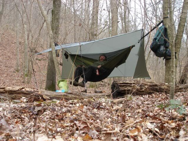
Fortunately, the way was easy and I made up the error fairly quickly. As I passed by the locked gate, I breathed easier, knowing my intended campsite would not have easy vehicle access. As I dropped into the valley, I found a perfect level spot with beautifully spaced trees near flowing creek. I was home for the night. I kicked back in my hammock-recliner, cooked dinner, and enjoyed the rest of my evening.
Tuesday, March 16, 2010
I was up early again, ready to push onward again. I made very good time along a low ridge. I was looking forward to a sit-down lunch at picnic tables at the Narrows Picnic Area. Unfortunately after 5.8 miles, I arrived to find the picnic area was only a gravel parking lot. I continued onward and spoke to my first person of the trip. A motorcyclist approached me and asked how the gravel Narrows Road looked. I explained that I had only walked perhaps a mile of it that morning, but what I saw had been in good shape. He then prepared to move on up the road.
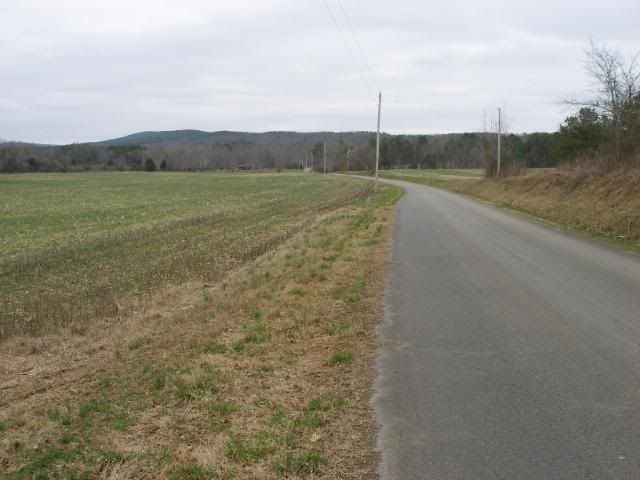
I continued on and the graveled Narrows Road turned to pavement and entered farm country.
I pulled on my windshirt and pants and four dump trucks drove by. Then I pushed on until I got away from pavement. I stopped for lunch, relaxed for a bit, then began my ascent up Strawberry Mountain. As I began my descent, the trail was crossed by a couple of bulldozer cuts. I suddenly found myself walking down one of these cuts and began to turn around to rediscover where the Pinhoti had gone. But then I noticed a white blob blaze indicating this bull-dozer cut was the trail itself.
Once I crossed FS 227, I headed up another wide open easy-rolling logging road. My only deterrent was the beginnings of minor shin splints in my right shin. Still, I moved along swiftly. I soon passed a small burn area. Normally I detest burns, but this area offered a very nice view down into the nearby valley.
I then pushed a bit further down. I was hoping to find a good stealth site near West Armuchee Creek. It was only about 200 yards from the paved Manning Mill Road, and I didnt want to stand out near that easy access. Fortunately a heavy layer of trees (as well as the creek) separated me from the road and I found an excellent spot to camp. I even rigged my tarp back to try to catch some stars as the overcast began to break up a bit.
It was an excellent camp. The paved road I feared was so little used that I only heard four vehicles on it all night. Dewey even took charge of keeping the cocoa warm as we enjoyed the stars above that night.
Wednesday, March 17, 2010
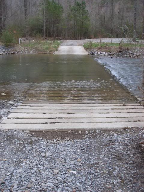
Saint Patricks Day started off very rough for me. My shin splints had transferred into my right ankle, and I had trouble bearing weight on it. To make matters worse, I couldnt use a brace of even lace up my boots snug as I needed to start my morning in crocs while I forded the cold water of West Armuchee Creek.
Fortunately, between 400 mg of ibuprofen, snug-laced boots, and a mile of smooth paved road walk, my ankle warmed up and became much more comfortable in the first half-hour of movement.
As the days miles drifted by, my St. Pattys Day got better and better. My Mr. Parkay maps showed a distinct divergence from the pocket guide. I could tell the trail had been relocated so it now wandered through the Keown Falls Recreation Area of the Chattahoochee National Forest. I would climb an extra 400 feet to the top of Johns Mountain, but I would enjoy a string of rewards I did not expect that morning, trail magic in its truest sense.
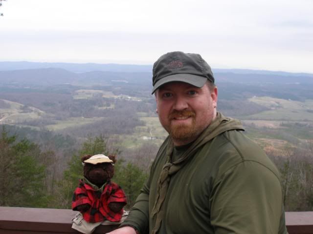
As I crested Johns Mountain, Dewey and I were greatly impressed with the developed overlook there.
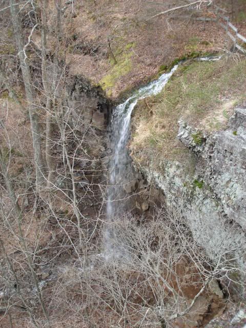
As we continued downhill on the Johns Mountain Trail, we enjoyed Keown Falls.
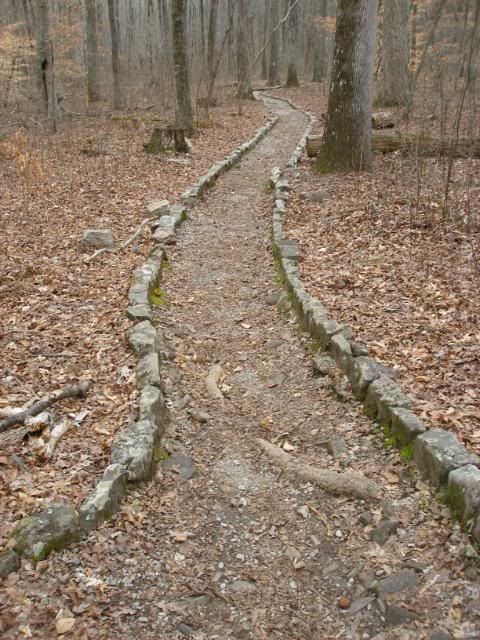
The Johns Mountain Trail was wonderfully charming with cobbled sidewalls.
And the trail ended at a gorgeous picnics area, complete with a trash can and the nicest smelling privy I have ever used. So help me, it smelled like vanilla.
I pushed on up the forest service road to the Paved Pocket Road, then caught the old roadbed at Pilchers Pond Trail head. 9/10ths of a mile later, I was greeted with the nicest surprise of all in my afternoon of relocations. Pilchers Pond was an absolutely beautiful spot, with a nearby ridge that offered good campsites as well as a picnic table.
The day which had started so rough had yielded the best afternoon of the entire section, all the more wonderful because it was so unexpected. I slept well, having enjoyed the best St. Patricks Day in a long time.
Thursday, March 18, 2010
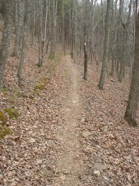
The nature of the trail changed dramatically today. Gone were the sections of cleaned up logging road. Todays trail was almost entirely new single track trail. I pushed up Horn Mountain, a climb of maybe 500 feet. The trail was well made. Side hill cuts were generous, and the overall tread was smooth.
As I headed downhill, I soon reached Snake Creek Gap Trailhead, by far the largest on the Georgia PT, at least an acre in size. I used the privy at the parking lot and headed uphill. This time, the tread grew a good bit rockier than the previous single track sections. But as the trail grew a bit rougher, the clouds parted and the first blue sky and direct sun of the trip streamed down. A large cairn marked the crest of Mill Creek Mountain.
I would follow this ridgeline north for three more miles before I descended to my camp. My shin splints had returned and were noticeably, but I still made solid time down to Swamp Creek. The largest campsite of the entire 72-mile section waited for me there near the first crossing.
As I was cooking supper, I saw my first mountain biker of the trip around 6 PM. He said hello and carried on. Mountain bikes are allowed on almost the entire Georgia Pinhoti Trail and I had seen many tracks for the last five days. I was surprised it had taken so long to finally see a rider. He was the first person I had met on actual trail and only the second person I had talked to during the hike.
I turned in, ready for an early start the next day.
Friday, March 19, 2010
My alarm rang at 5:30. I wanted to get moving as early as possible so I could finish the 12 miles to my truck and get through Chattanooga before rush hour hit. I ate quickly, packed, and was walking by around 6:20. There was enough light I did not need to hike with a headlamp, but it was still dim and chilly (about 38 degrees).
The route formed a dizzying series of ridge walks. I walked south, up an old roadbed for the first two miles to the top of Middle Mountain. Then I turned north on the ridge for two miles. I then turned south along the crest of Hurricane Ridge for yet another 2 ½ miles. At England Spring Gap, the trail finally turned north for four miles along Rocky Face to end at Dug Gap Trailhead.
The trail lived up to its name along Rocky Face with a host of rocks underfoot. This did not deter a couple of mountain bikers who rolled along south. I said hello as they rolled on by.
Finally I reached the ridge where FS 202 began at an array of more than a dozen radio towers. A half mile graveled road walk to Dug Gap Battle Road yielded some nice views.
Shortly after, I arrived at the trailhead. I packed away my trekking poles and prepared to head downhill.
There was a small strip of gravel to park on at the trailhead, but I was not comfortable leaving my truck in this exposed area for a week. I had parked 1 ½ miles downhill at the Dalton Convention Center instead. I now had to stroll the final home stretch to my truck giving me a chance to appreciate the road walk a thru-hiker would experience.
As I arrived back at my truck at high noon, I had to admit, the Georgia Pinhoti Trail was quite different in character from the Alabama portion. But at the same time, I had found the previous 72 miles very satisfying.


 Reply With Quote
Bookmarks