


Saturday, February 26, 2011
I had been sick earlier in the week, but I had been planning for to hike the first 19 miles of the Bartram Trail before Spring break this year, so I could finish the remaining 90 miles at a more leisurely pace over my break in late March.
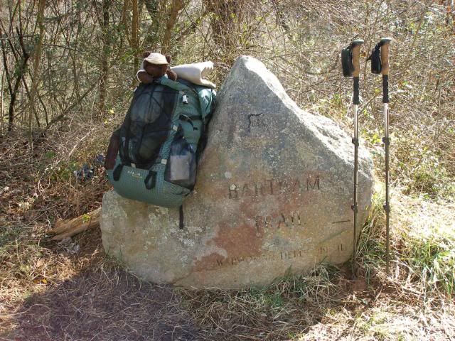
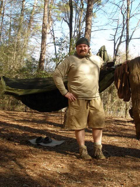
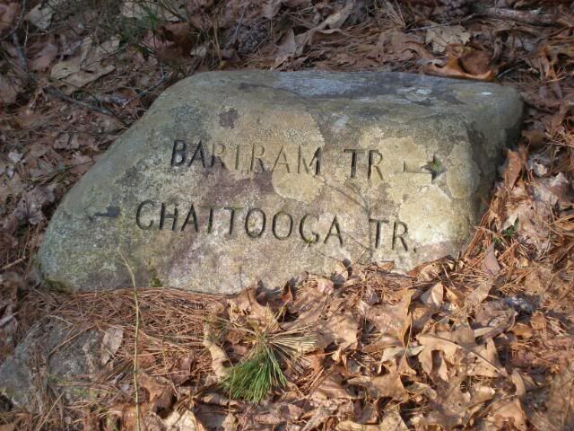
So my wife dropped me off around 10:30 on this Saturday morning at the Russell Bridge Trailhead. This small parking lot is on Highway 28, just north of the Chattooga River bridge that leads into South Carolina. There, Dewey posed for a picture with one of the many engraved boulders that mark key points along the Bartram Trail.
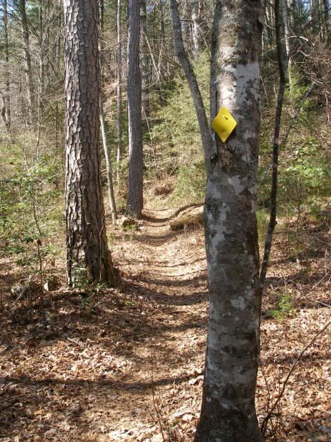
Then we crossed the highway heading west, following the general course of the Chattooga River. Shortly into the walk, I passed the first of the plastic yellow diamond blazes that mark the Bartram Trail.
I was surprised at how well the BT is maintained and blazed. The guidebook mentions several blazes where blazes and cross-trails could be confusing. But the folks who maintain the BT have clearly spent some quality time taking care of this corridor. There was never a confusing point during the entire weekend.
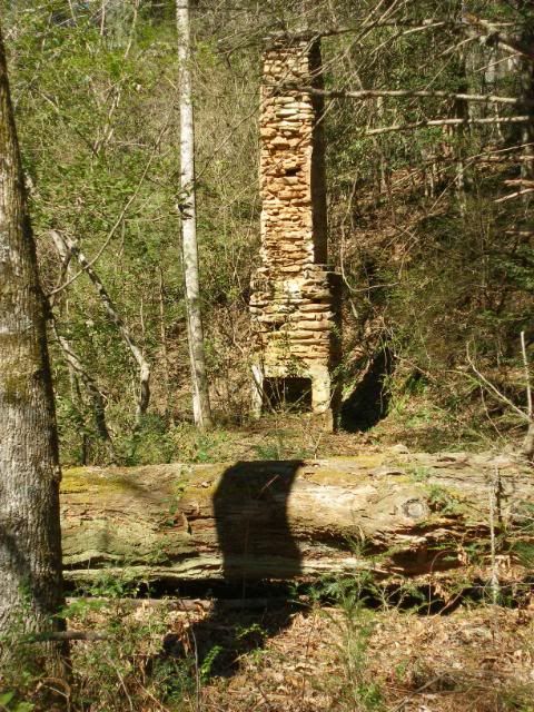
The area along the trail had once been a road bed and reminders of the folks who lived there remained. An old hay baler stood out as evidence this path once catered to vehicles.
Just after, the foundation and chimney of a vanished home gave witness to the past.
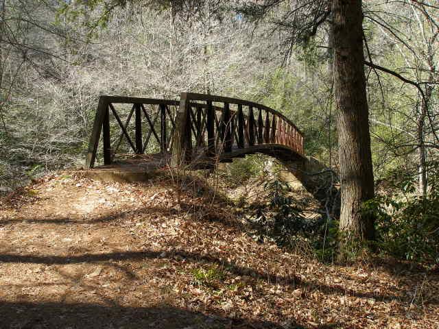
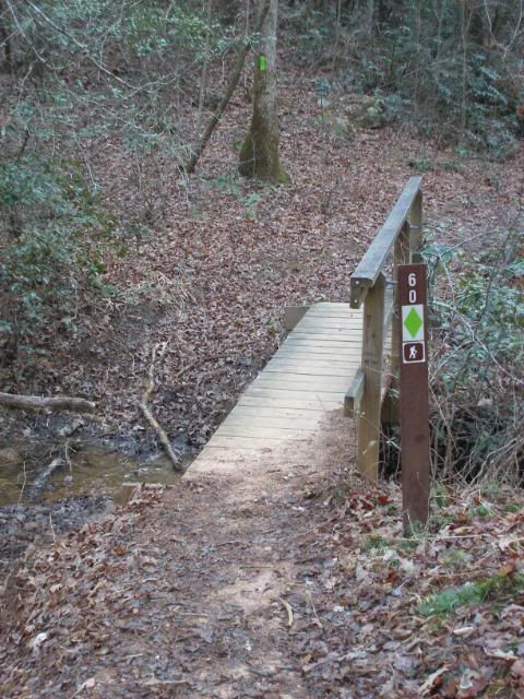
The trail was relatively level, and despite some mild weakness from the previous weeks illness, I ambled on with relative ease. Occasional glimpses of the Chattooga greeted me as I wandered on. As I approached Warwoman Creek, I was happy to see one of the longer bridges along this section of trail, preventing the need for a ford.
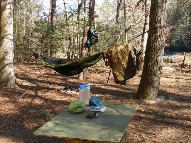
Shortly after, I passed by the Earls Ford area, I eased around a car campsite and moved along swiftly. On the other side of the camp, I encountered a couple of dayhikers wandering along. They were the first people I had seen in 6 ½ miles of trail. I continued on, planning to make my way to a campsite around mile 9 near Dicks Creek Falls. However, just past mile 8, as I passed a couple of fly fishermen, I spotted a beautiful flat improved campsite along the Chattooga. At 2:30, a mile from my planned camp, I had found home for the night.
After setup and a bowl of soup, I posed for a quick shot with Dew Bear.
Then I settled in for a wonderful nap. Around 5:30 I rose and cooked a dinner of chili mac. I settled back in to read for a while. My head cold and congestion of the past week began to seep back in and I spent a good deal of time clearing my sinuses until some Benadryl kicked in, and I could finally drift back to sleep, a sky of stars my last images.
Sunday, February 27, 2011
I was up and moving reasonably early, despite only a so-so night of sleep. My cold was a part of the problem. Also, I was using my wifes Hammock Gear 3-Season Burrow overquilt. The night only got down to about 40 and the quilt was more than warm enough, but the narrow cut at the legs was a touch more snug than I would have liked in my hammock. If I had been using a full-length underquilt, there would not have been any cold spots. But with my Yeti underquilt (a 2/3 model) and a pad at the legs, there were a couple of narrow gaps that the pad would not wrap around, and the snaps would pop loose as I fell asleep and my feet spread.
What can I say? I have thick legs and thick wide feet. I come by my name honestly.
I would wake up, adjust, and go back to sleep again. If I had put on my pants, it probably would have solved the problem, but with a 20 degree quilt in 40 degree weather, I never got cool enough to warrant the switch. Ironically, my main worry was that my upper body would be too exposed, as the quilt has a 48-inch girth and my chest is around 52 inches before you add arms. But with the wrap of my underquilt, it was never a problem.
I enjoyed a breakfast of a bacon sandwich and hit the trail around 8:00. A mile later, I passed the nice campsite listed in the guidebook. It really was very nice, but it lacked the chatter of the Chattooga from the night before. Just past the site, I joined the side trail to Dicks Creek Falls.
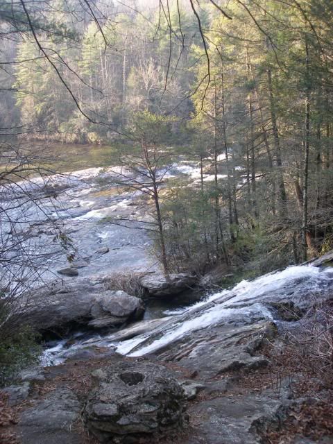
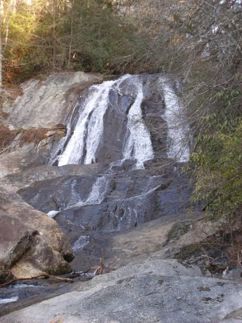
It was a short walk down the trail to the top of the falls.
Then a steep 20 or so yard bushwhack down to the beach at the base of the falls.
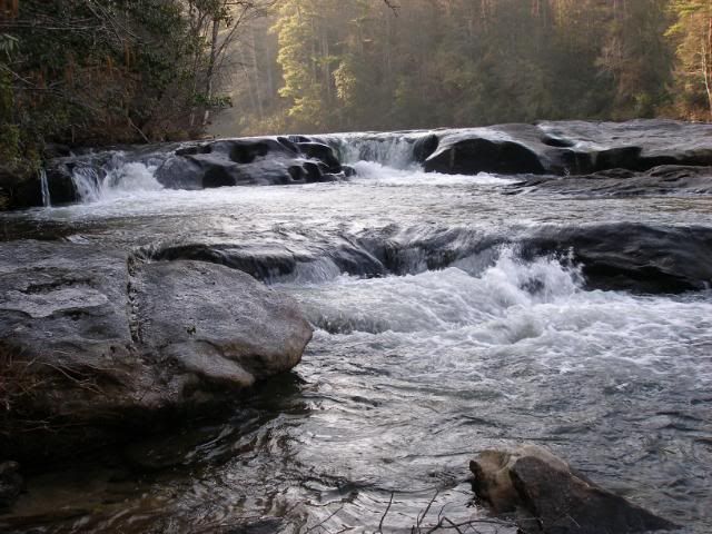
To my back, the Chattooga River rapids rolled on by.
As I rejoined the Bartram Trail, I began a series of short climbs. Just past the first one, the Bartram and Chattooga Trails, which had run together since I stepped off the previous day, finally parted ways.
I couldnt help but think I had to walk the full 20-something mile Chattooga Trail in warmer when the river would offer comfort from a sweaty day.
Then I headed up a 700 or so foot climb that brought me to a long ridge walk that I would follow most of the day. Views would be minimal, though the lack of spring foliage offered me some partial images of the surrounding mountains. The short ups and downs began to really wear on my, and I could tell I wasnt fully past whatever bug had haunted me. The roller coaster reminded me very much of the Georgia AT. But despite a bit of weakness, I still rolled along, lulled into a rhythm, spooked out of it by the explosion of the occasional grouse, and ambling ever onward.
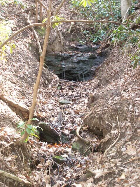
Water was somewhat limited on these ridges. A couple of sources were noted in the guidebook, well down into the gorges, but I pushed on to the joyful little waterfalls just off trail around mile 15. It was very very welcome.
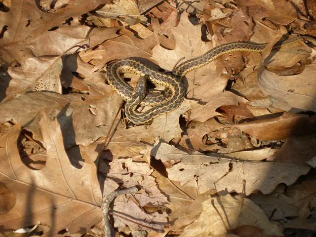
The afternoon was warming up nicely, and even some cold-blooded cousins came out to enjoy the weather.
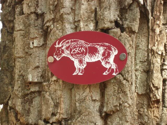
I rolled onward, enjoying an occasional view down to Camp Rainey Mountain, the local scout camp and its lake. Around mile 17 I passed the Goat Trail an access trail from the camp.
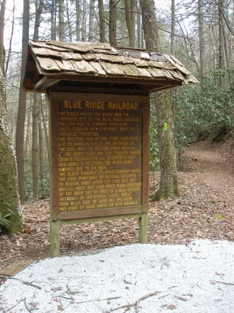
Despite huffing and puffing a bit on the hills, I sped up knowing my truck was waiting just 1 ½ miles beyond. I pushed on well and eventually came to Warwoman Dell Picnic Area. It was a nerve-wracking descent because I could see picnic shelters and parking areas, but no sign of my truck. As I arrived at the shelters and signs with maps, I realized this picnic area was quite a bit bigger than I had realized. I relaxed enough to read a couple of interpretive signs, including the one about the old Blue Ridge Railroad in this area.
From there, I headed down the gravel road about perhaps a quarter mile, where I found my truck waiting. I stowed my gear, turned over the engine, and began my drive home, thoughts of returning to this place in three to hopefully finish the Bartram Trail.


 Reply With Quote
Bookmarks