Page 1 of 3 123 LastLast
Results 1 to 10 of 23
  1. #1
    Senior Member Bearpaw's Avatar
    Join Date
    Jul 2008
    Location
    Ooltewah, TN
    Hammock
    BIAS Camper
    Tarp
    WB Edge
    Insulation
    WB Yeti/HH Incubat
    Suspension
    UCRs
    Posts
    430
    Images
    17

    Savage Gulf State Natural Area (TN), Oct '12

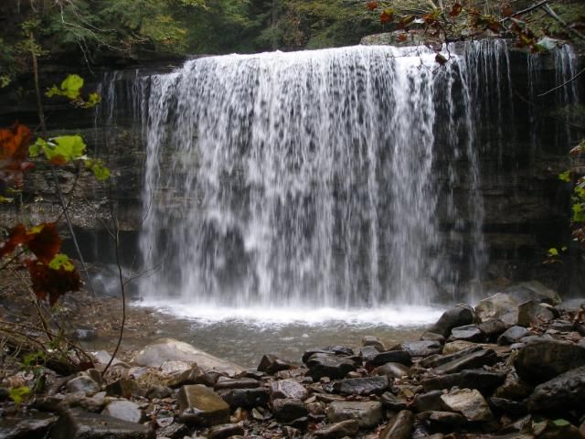
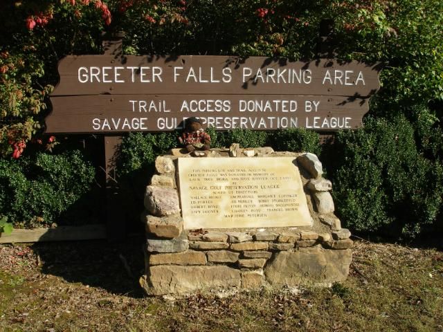
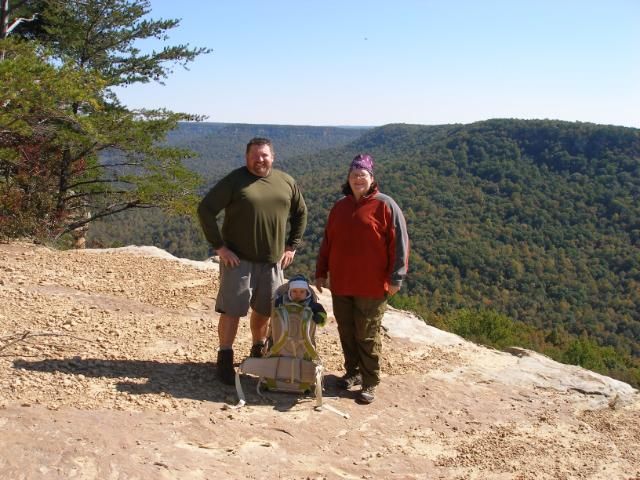
    It has been three years since my wife and I finished hiking all the trails at Tennessee’s Savage Gulf State Natural Area. I have told many people that it is my favorite hiking area in the southeast due to its mix of easy-to-moderate hiking with a host of great payoffs, such as great views, waterfalls, suspension bridges, cabins, and a healthy dose of general adventure.

    I hadn’t visited Savage Gulf since my family moved to the Chattanooga area 2 ½ years ago. I’ve been busy with other regional trails. But a mix of time off for fall break and tight finances convinced me this was a time to revisit an old favorite. I hoped to visit pretty much all of the area’s great sites and spend one night camping with my family. And despite unexpected cold and wet conditions, I mostly found what I was looking for.

    Monday, October 8, 2012

    I rose late and gathered my loaded pack and poles. And looked at the substantial rain coming down outside my window. Weather reports said rain should have ended overnight, and I would enjoy warm sunny weather from Tuesday through Thursday. So I checked the weather map online, and it showed this band of rain that had already left the Savage Gulf area I would hike just an hour northwest of my home. I kissed my wife and daughter goodbye, slid into my truck, and headed out.

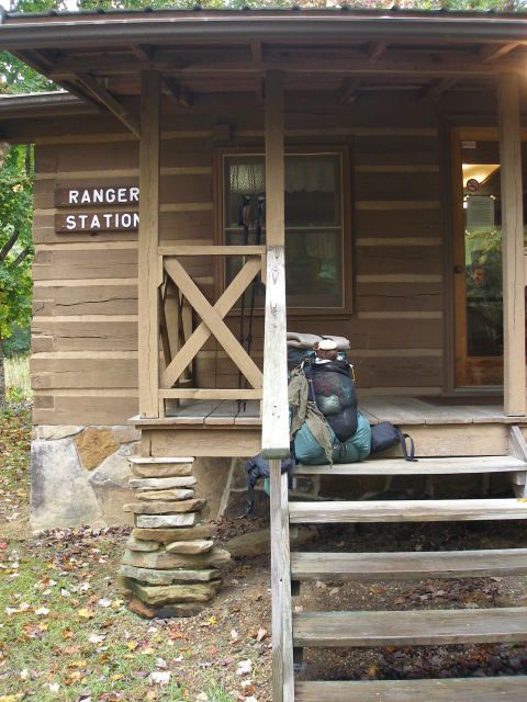
    One hour 10 minutes later, I arrived at the Savage Gulf Ranger Station, the closest of the four trailheads to my home.


    I headed up the walkway and Dewey watched my pack while I got my permit for three nights.


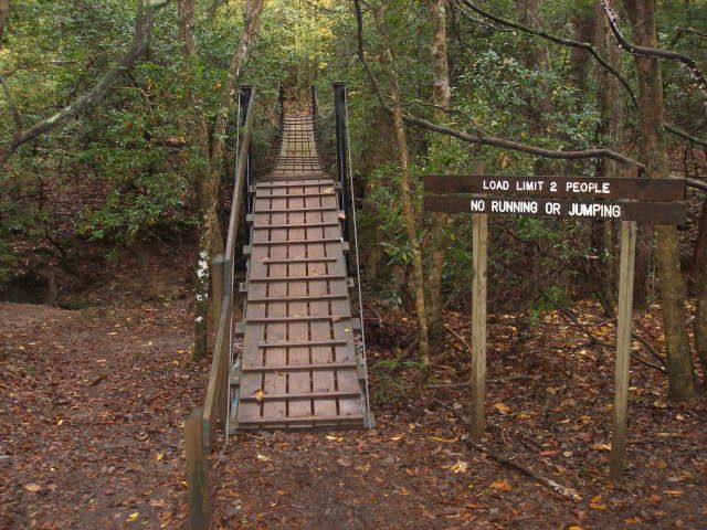
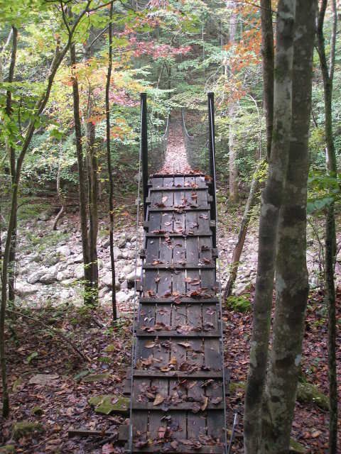
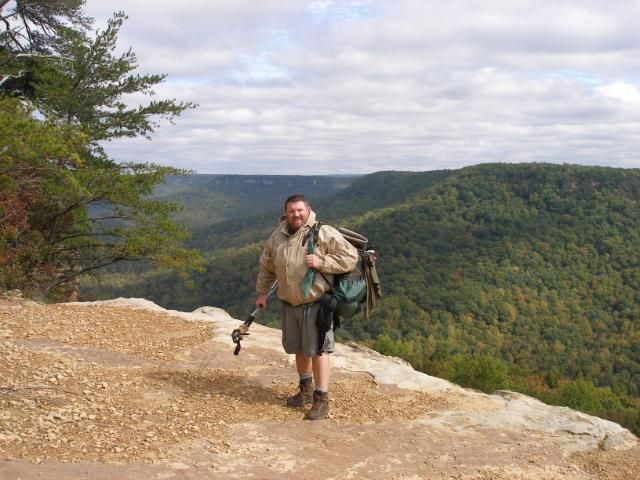
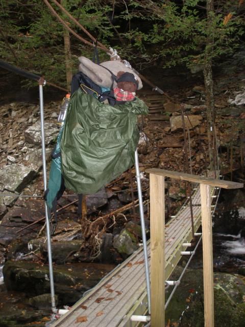
    Around 1 pm, I stepped off. My destination for night 1 was Hobbs Cabin Campsite. I knew the shortest, easiest route was a mix of several trails. So I headed up the Savage Day Loop. Half a mile in, I reached the first of ten suspension bridge crossings for this trip.


    At the beginning of the actual loop, I turned right, pushing another .9 miles to the North Rim Trail. Another suspension bridge and .3 miles and turned off the Rim Trail to the North Plateau Trail. This gave me a smoother, shorter route on the old Dinky Line railbed than I would get following the North Rim Trail. I made great time to Dinky Line Campsite and turned west onto the .8 mile Mountain Oak Trail. 20 easy minutes brought me back to the North Rim Trail, having saved 3/4ths of a mile. I enjoyed a quick lunch here.


    Though the day’s cool, misty conditions let me know fall had finally arrived here in the southeast, the first changes of color were a more pleasant reminder.


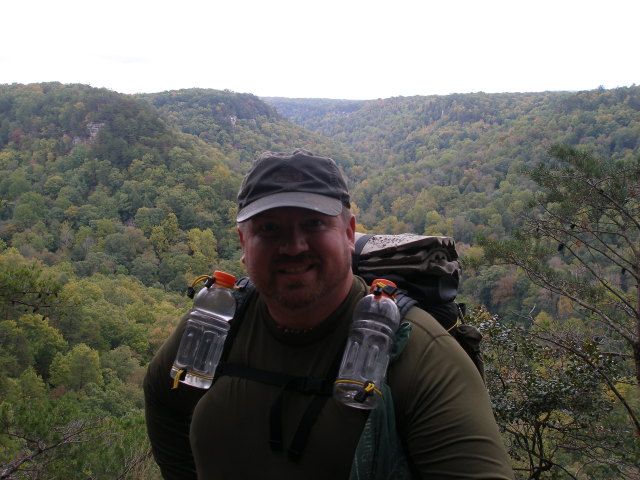
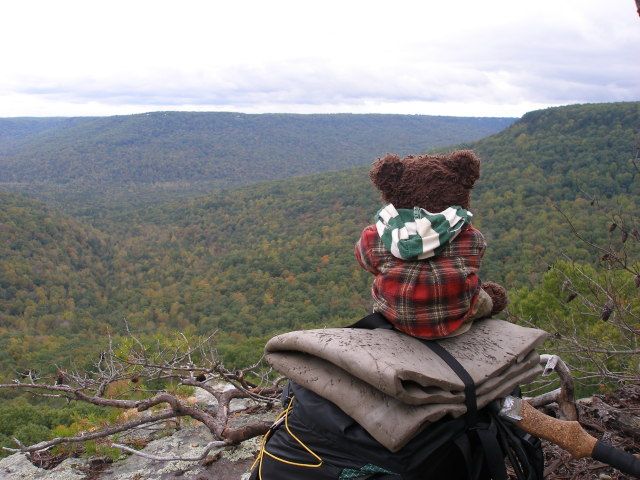
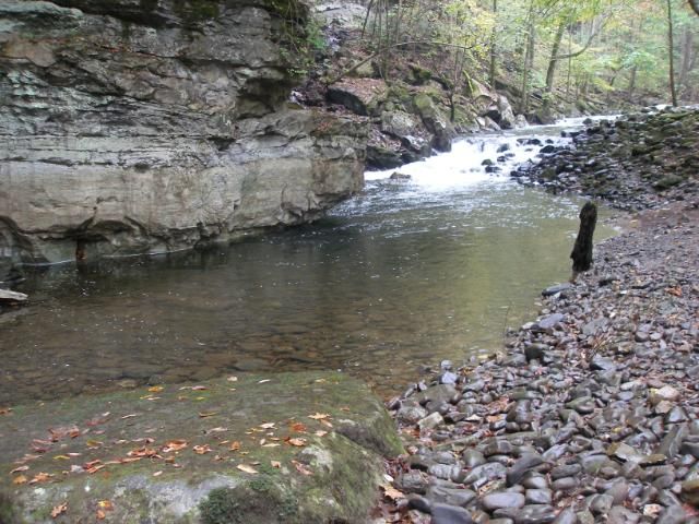
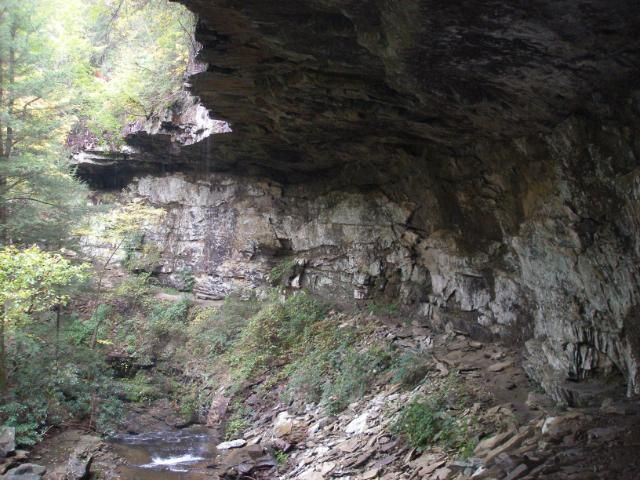
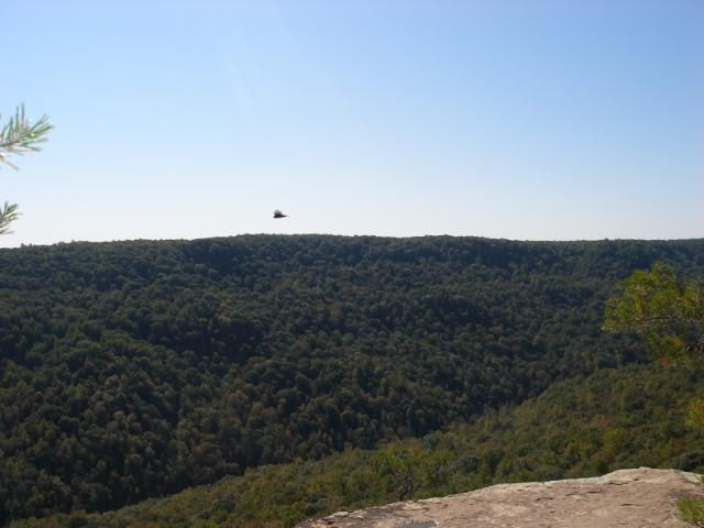
    Aside from great colors, the North Rim Trail also offers several nice overlooks, the tallest of which is at Yellow Bluff.


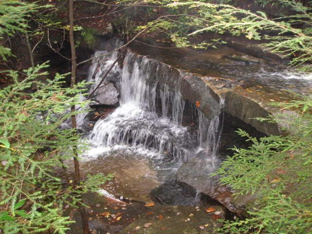
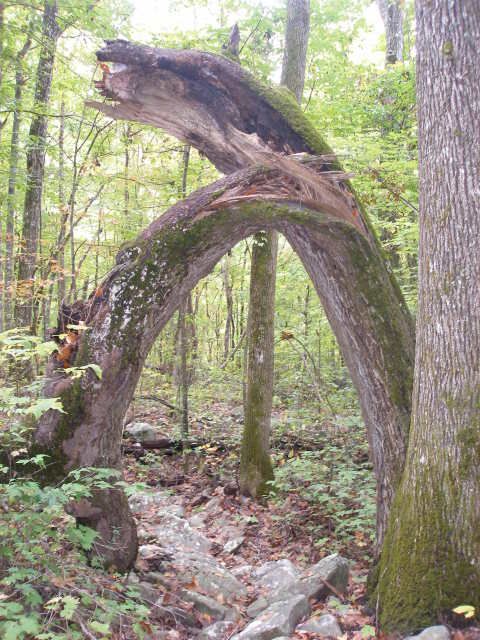
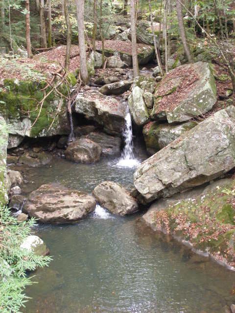
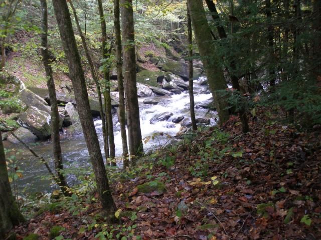
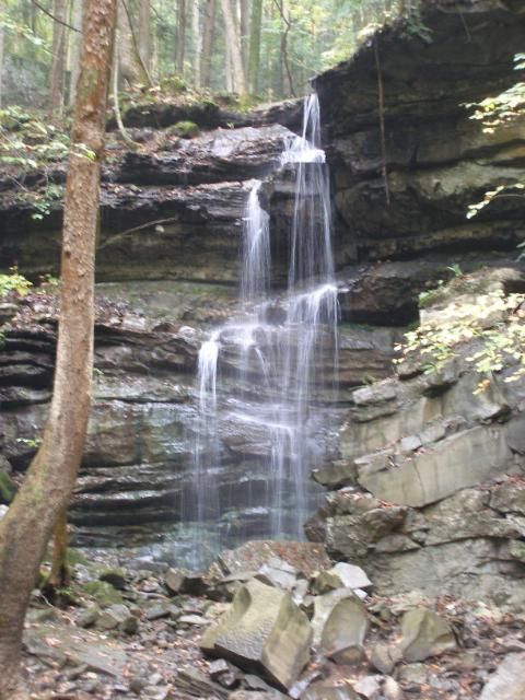
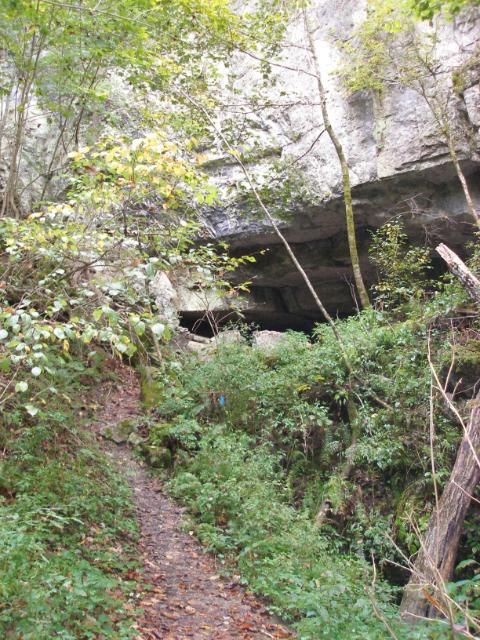
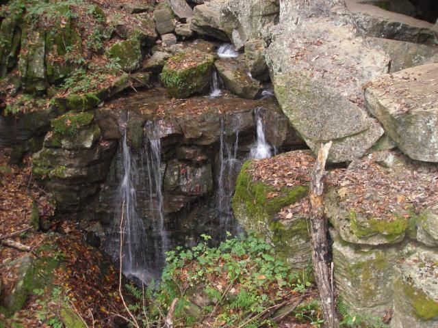
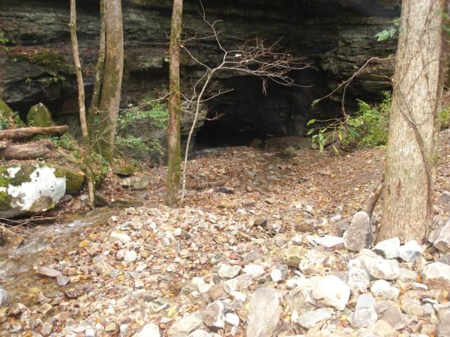
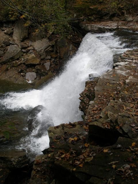
    As I walked, I had to appreciate how significant the drought conditions of 2007-2009 had been. I had done all of my Gulf walking during these years, and had gotten used to shallow streams and nearly dry springs. I was amazed at how many small streams I was crossing, all of which were bone dry in previous years. The only stream I remembered along the North Rim Trail now offered a beautiful waterfall.


    While all the rim trails in the area offer many nice views, none is so dramatic as the view at Tommy Point Overlook.


    While the angle of view is a bit bigger at the Stone Door, Tommy Point offers a view of nearly all the many gulfs in the Natural Area, converging in the area of Sawmill Campsite.


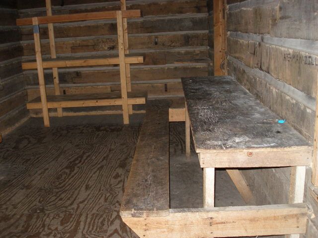
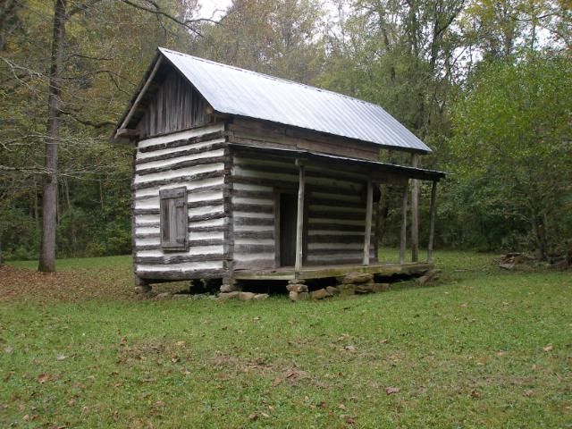
    After Tommy Point, I always feel like a horse heading to the barn, as it is just a little over one easy mile to Hobbs Cabin. Dewey and I arrived there in short order.


    The interior includes a kitchen area and six bunks.


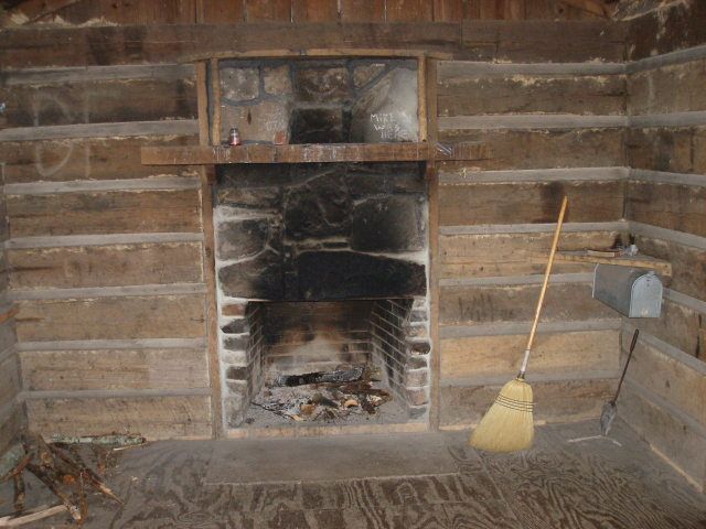
    And perhaps nicest of all, in cold weather at least, is the fireplace.


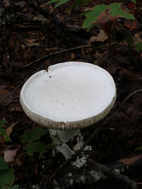
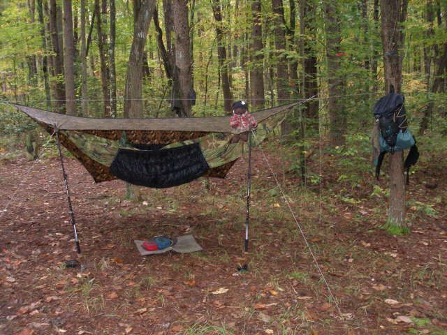
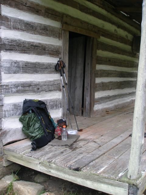
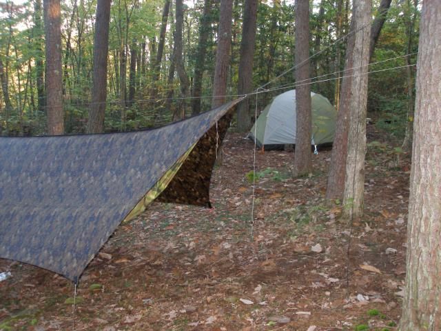
    My wife and I have spent several nights enjoying the warmth there. But on this night, I intended to enjoy the comfort of my hammock, so I headed past the cabin to the campsite area. Along the way, I noticed several large white mushrooms, shaped like birdbaths.


    I felt energized after an easy 8 mile walk. I quickly set up camp.


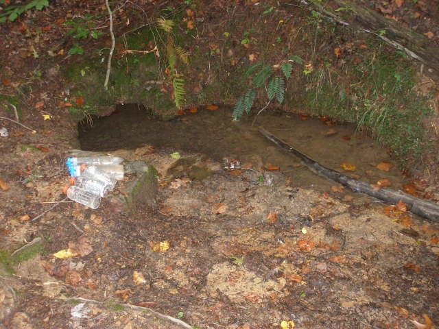
    Then I headed out to gather water at the spring behind the cabin. It was at least three times the size of previous visits, and perfectly clear.


    The evening was chilly, well down into the 40s, and pushing the comfort of my top quilt. I warmed up with a high calorie dinner of noodles with parmesan cheese and bacon bits. Then Dewey and I turned in. I read for several hours until I finally drifted off.

  2. #2
    Senior Member Bearpaw's Avatar
    Join Date
    Jul 2008
    Location
    Ooltewah, TN
    Hammock
    BIAS Camper
    Tarp
    WB Edge
    Insulation
    WB Yeti/HH Incubat
    Suspension
    UCRs
    Posts
    430
    Images
    17
    Tuesday, October 9, 2012

    I arose to a chilly morning. Even so, I was ready for a longer, considerably tougher day of walking than I had made the previous day. I knew from much experience that any travel down into the gulfs means rocks comparable to the Pennsylvania Appalachian Trail. It also means drier conditions in many cases, because the bottoms flow into tremendous underground sinkholes. Nearly all the suspension bridge crossings are over deep, bone-dry streambeds. A pause on a swinging bridge gives a thirsty hiker the tantalizing sound of water flowing down beneath the rocks. This phenomenon would be a regular companion over the next two days.

    After breakfast, and another cool, slightly misty morning, I stepped off. I immediately walked onto the Connector Trail, seven miles of rough rocky trail that runs nearly the whole east-west length of the Savage Gulf complex.


    I’ve termed the first mile “The Grey Mile”, a savage jumble of bowling ball style rocks with an occasional white blaze to mark the trail.


    Fortunately the Grey Mile is mostly level, paralleling the North Rim Trail about 100 yards up above it. While requiring some careful footing, it does not require much in the way of dangerous ascent or descent. Near the end of the Grey Mile, a shattered tree welcomes the hiker to a slightly easier section of trail.


    Then I began a series of mild switchbacks to the edge of Savage Creek. Here, the rocks begin again. They claimed most of the tendons in my wife’s right ankle four years earlier, an injury from which she spent 14 weeks recovering. I carefully made my way to the bridge over the dry bed of Savage Creek.


    From this point, the trail eases up considerably in difficulty. There are small climbs and plenty of rock, but nothing as severe as the first couple of miles down from Hobbs.

    I made good time, pushing past Sawmill Campsite, 3.5 miles into the Connector Trail. I bypassed the historic site at Decatur-Savage Cabin, knowing I would head this way again on Wednesday. I crossed three more suspension bridges, finally stopping six miles up the trail, to grab water at Laurel Creek.


    I wolfed down lunch here, ready for a good climb out of the gulf to the Stone Door. I began the uphill half a mile later at the intersection with Big Creek Gulf Trail. The sun briefly popped out as I reached top of the gulf, looking up through the crack in the massive rock face known as the Stone Door.


    Once at the top, I pulled on my jacket to cut away the chilly wind and snapped at shot from the expansive Stone Door Overlook.


    I then moved back into the cover of the treeline, grabbed a snack, then stepped off on the last 3.2 miles to my day’s destination, Alum Gap Campsite. It would be an easy, mostly level rim walk, complete with four nice overlooks along the way. Despite the trail’s ease, my legs and ankles were feeling the stress of walking rocks all day long. I arrived, tired but satisfied, just after 4 pm.

    I knew I was there when I saw the sky blue privy found at every designated site in the Savage Gulf complex. This one sported a sun roof.


    The afternoon was somewhat warmer than the previous day with occasional bits of sunshine peeking through. I took advantage to lay out my wet, sweaty clothes so they could dry a bit. Then I set up my camp.


    Another good dinner and evening of reading followed. Alum Gap Campsite is only three miles from the Stone Door Ranger Station and trailhead so I was not surprised to have a bit of company, with two other groups camped there. But I ultimately enjoyed a quiet evening that led to a good night’s rest.

  3. #3
    Senior Member Bearpaw's Avatar
    Join Date
    Jul 2008
    Location
    Ooltewah, TN
    Hammock
    BIAS Camper
    Tarp
    WB Edge
    Insulation
    WB Yeti/HH Incubat
    Suspension
    UCRs
    Posts
    430
    Images
    17
    Wednesday, October 10, 2012

    This would be my toughest day. I knew this ahead of time. 12 miles, entirely down in the rocks of the gulfs. But I also knew I would enjoy many great rewards, including four waterfalls, an historic cabin, a small cave, and my wife and daughter waiting for me at Collins Gulf Campsite.

    I stepped off and headed down Big Creek Gulf Trail in yet another damp, misty morning with occasional sprinkles. While my ankles screamed with stiffness and tenderness, they grudgingly carried me down the rocky descent. Big Creek rumbled along beside me as I made my way.


    The stream seemed huge compared to the trickle I remembered from four years earlier. Dramatically, the whole creek disappears at Big Creek Sink. The creek forms a large pool here, actually swirling like the water in a huge bathroom sink, draining underground.


    Just above the sink, a small waterfall adds to the underground pool.


    From this point onward, Big Creek was a boneyard of rain slicked boulders. Half a mile later, I reached the ½-miles side trail to Ranger Falls. Along the way, I took a fairly dramatic fall. I tucked into a sideways position that protected most of my body, but sacrificed my right elbow and knee. Thankfully, the abrasions and bruising were relatively minor and I headed on to the roaring Ranger Falls.


    Then I headed out, quickly reaching the intersection with the Connector Trail. I now headed east, again scrambling over its three bridges and many rock. This time, I made the ¼-mile side trip down to the historic Decatur-Savage Cabin.


    Dewey and I took a quick lunch on the porch here, getting out of the occasional sprinkle of rain.


    Then I packed up and headed on, joining the Collins Gulf Trail at Sawmill Camp, just after crossing the Collins River bridge.


    The next four miles would carry me 1000 feet higher, back up to the rim of Collins Gulf and my family waiting for me at Collins West Campsite. But first, I would take the ¼-mile climb on the side trail up to Schwoon Cave and Spring.


    Once there, it took a bit of rock scrambling to reach the actual spring, back behind the boulders that formed the waterfall.


    Then I stepped back to the trail and the gradual climb. I was treated to another abrupt sink, where Fall Creek disappeared into a cave.


    Another short uphill grunt brought me to the side trail down to Horsepound Falls, on the Collins River. I was again struck by the intensity of the flow here, just a trickle in 2009.


    And the final two mile opened up before me. Sometimes, the trail was smooth and level, sometimes rocky and uphill. But the miles melted away, bringing me to the massive overhang of Rocky Point and the Himalayan “disaster”-style ladder bridge over Rock Mountain Creek.


    Dewey complained that there was only supposed to be one person at a time on the bridge, and I should send him over alone, then cross. Eventually I convinced him it would be safe for both of us. I also snapped a shot of the falls of Rocky Mountain Creek.


    Then we proceeded along the trail, hugging the wall of the Rocky Point.


    Then I pushed up the last few rocks to the intersection of the Collins Gulf Trail and the Collins West access trail. Another 200 yards and I was walking the blue-blazed Collins West Campsite loop. 2/3s of the way around, I found our tent set up, but no sign of my wife or daughter. I dropped my pack and told Dewey to watch the camp.

    I then headed up the .4 mile access trail to the parking lot. Halfway there, next to the site’s spring, I found my wife carrying our daughter in her child pack and pulling a second load of gear in a stroller. I pulled the stroller the rest of the way back to camp. Once there, my daughter pointed out that we were in campsite 4.


    We finished setting up camp while our daughter played in the glorious dirt. By around 6:30 camp was set up and ready for the night.


    The weather was still cold and overcast. I finally changed into my cleanest, driest clothes and we discussed options. Neither my wife nor I were in the mood to gather wood for a fire. We both decided to eat out for the evening. We loaded up our daughter and hiked out to the car. From there, we retrieved my truck from Savage Gulf Trailhead and found a diner with a high chair for our daughter. It wasn’t the greatest meal I’ve ever had, but it was so good to just sit in a warm dry place.

    Afterward, we headed back to Collins West, walking in by headlamp. Our daughter was tired in a happy kind of way, and she went to sleep pretty quickly once we got back. My wife and I chatted for a bit, then headed off to sleep ourselves. It had been a long, tiring, cold, somewhat painful day, but it had ended decidedly well.

  4. #4
    Senior Member Bearpaw's Avatar
    Join Date
    Jul 2008
    Location
    Ooltewah, TN
    Hammock
    BIAS Camper
    Tarp
    WB Edge
    Insulation
    WB Yeti/HH Incubat
    Suspension
    UCRs
    Posts
    430
    Images
    17
    Thursday, October 11, 2012

    Day came a bit later than usual. I knew I was only doing a couple of short dayhikes with my family, so I slept in as much as I could manage. With my daughter for an alarm clock, this meant about 8:15. Then she was up, bundled and ready for a day of adventure.


    Between watching the wee one and packing up, we were pretty slow. But with both mom and dad working together, we were able to bring every thing out in one trip, arriving back at the vehicles around 10 am. The sun was out, the morning warm, and we decided to change our daughter from her parka to a light liner jacket. But once she was free from her carrier and heavy clothing, the Magpie made her break for freedom.


    Some minutes later, we finally got her dressed again and into the car. Then we headed up to the northwest side of the Natural Area. This meant a trip to Greeter Falls Day Use trailhead.


    My wife used the half-hour to feed breakfast to Emily while Dewey and I made the 1-mile round trip to Greeter Falls. I could have made a 3-mile round trip from Alum Gap on Tuesday, but I honestly just didn’t feel like it. With the easy access here this morning, I felt good about that decision.

    The trail moved steadily to the spiral staircase above the falls.


    This strange contraption is actually a very efficient way to handle the need for a rapid drop down a sheer face. From there, wooden stairs lead down to the plunge pool and the falls.


    In warm weather, this area is a favorite local swimming hole. But this morning, Dewey and I had it all to ourselves.

    A quick walk back and another 10-minute drive brought the family to Stone Door Ranger Station, the final trailhead with access to the Gulf area. There was still enough chill in the air that we kept Emily in her liner, mittens and warm hat. Once strapped into her carrier, she was ready to hike.


    The trail from Stone Door Ranger Station to the Stone Door is probably the easiest mile in the entire Natural Area.


    The first .3 miles is actually paved, all the way to Laurel Gulf Overlook’s observation deck.


    The remaining trail is fairly mild, ending at the breath-taking overlook, complete with soaring hawks on this morning.


    We all enjoyed the view and the peace. After a few minutes, we snapped a family photo.


    Then we headed back. On the way back to my truck and home, the little Magpie decided she’d had enough adventure for one day.


    Once back to my truck, I switched vehicles and we all headed home.

  5. #5
    Senior Member swankfly's Avatar
    Join Date
    May 2012
    Location
    South Louisiana
    Posts
    1,429
    Images
    6
    Wow, that's great, I have been to Savage Gulf three times and I never knew it could have so much water, I will put it back on my list again!

  6. #6
    Senior Member mbiraman's Avatar
    Join Date
    Nov 2009
    Location
    West Kootenays,BC,Canada
    Hammock
    Warbonnet BB DL 1.1 & Lite Owl
    Tarp
    Black MacCat Del.
    Insulation
    Yeti 3,4 & HRQ/HGB
    Suspension
    webbing/whoopie
    Posts
    4,244
    Images
    7
    Nice looking place . Glad to see you and Dewey out on the trail.

    bill
    " The mind creates the abyss, the heart crosses it."

    “The measure of your life will not be in what you accumulate, but in what you give away.” ~Wayne Dyer

    www.birchsidecustomwoodwork.com

  7. #7
    Senior Member 2ply's Avatar
    Join Date
    Oct 2006
    Location
    Soco Gap, NC
    Hammock
    Clark DLX, ENO SN, BIAS WWM
    Tarp
    OxPalace,Big Squid
    Insulation
    Oxgear, KAQ, WL
    Suspension
    Whoopies/Dutchware
    Posts
    1,798
    Images
    3
    Another great trip report. Thanks for taking us along.
    Everyone ought to believe in something....I believe I'll go set up the hammock!

  8. #8
    Senior Member ofuros's Avatar
    Join Date
    Aug 2011
    Location
    Australia...Sub-Tropical Qld, Temperate Tasmania & Tropical Thailand
    Hammock
    Madtree Tarseer
    Tarp
    DIY Cuben
    Insulation
    Warm & fluffy
    Suspension
    Slings and Rings
    Posts
    1,314
    Images
    22
    Great looking area, bearpaw.
    Thanks for sharing it.
    Mountain views are good for the soul....& getting to them is good for my waistline.

    https://ofuros.exposure.co/

  9. #9
    Senior Member Bearpaw's Avatar
    Join Date
    Jul 2008
    Location
    Ooltewah, TN
    Hammock
    BIAS Camper
    Tarp
    WB Edge
    Insulation
    WB Yeti/HH Incubat
    Suspension
    UCRs
    Posts
    430
    Images
    17
    Savage Gulf is a real treasure for the sheer number of great sights and features in a fairly small area. The hiking is quite easy so long as you stay up on the rims. With over 55 miles of trail, you can make tons of loops or one-ways. I can't believe I hadn't visited in almost 3 years.

  10. #10
    Senior Member Les Rust's Avatar
    Join Date
    Sep 2008
    Location
    Athens, TN
    Hammock
    DIY
    Tarp
    WL Big Daddy
    Insulation
    AHE/WL/DiY
    Suspension
    straps and stuff
    Posts
    984
    Thanks for the pics and report, Bearpaw. Yes, it looks like a lot more water than the last time I was over that way. I love the sinks and creeks and rocks in that area. Glad you and the family got out together for some quality time.

  • + New Posts
  • Page 1 of 3 123 LastLast

    Similar Threads

    1. TN>SAVAGE GULF>6th and 7th last min.
      By Benton Wahl in forum Southeast
      Replies: 1
      Last Post: 03-08-2014, 22:11
    2. Savage Gulf March 29-30
      By Jtupnsmoke in forum Southeast
      Replies: 0
      Last Post: 03-03-2013, 23:56
    3. Savage Gulf, Jan 26-27. Any interest?
      By ZakBait in forum Southeast
      Replies: 33
      Last Post: 01-25-2013, 20:08
    4. Talk it up-Savage Gulf
      By MedicineMan in forum Southeast
      Replies: 76
      Last Post: 12-29-2012, 20:59
    5. Any Savage Gulf Suggestions?
      By Minotaurus in forum Hangouts, Campouts, and Trip Planning
      Replies: 10
      Last Post: 04-21-2011, 16:10

    Bookmarks

    Posting Permissions

    • You may not post new threads
    • You may not post replies
    • You may not post attachments
    • You may not edit your posts
    •