


Originally this hike was supposed to be 7 days hiking along the Florida Trail through the St. Marks National Wildlife Refuge. I ended up cutting the hike short due to sickness but still I had a great time the three days I was out.
The hike itself was organized by the Apalachee chapter of the Florida Trail Association and would cover the 150 miles of the trail that is maintained by the chapter. This section of the trail stretches from the Apalachicola River in the Florida Panhandle east through the St. Marks National Wildlife Refuge (SMNWR) and then ends at the Aucila River. My plans were to meet them on Friday when they entered the SMNWR and hike the last half of the trip with them.
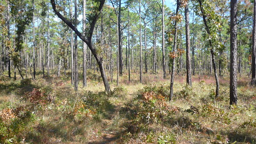
I got dropped off at the trail head on HWY 319 a little after noon and with clear blue sky and temps in the low 70's it was a day made for hiking. With only six miles to go I didn't feel any need to rush and set out an easy pace through the pine forests, scrub bush and palmettos that are common in this area of Florida.
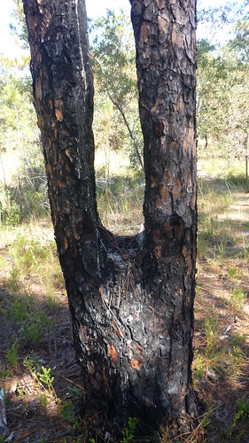
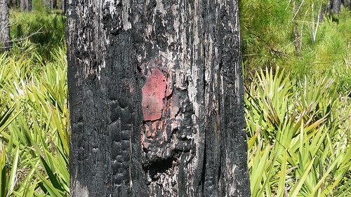
One thing I did notice, and was highly evidenced through out the hike were burn marks on many of the trees. I am not sure if this was from a wildfire or if it was from controlled burning in the area.
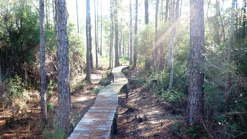
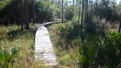
Another feature were an abundance of these little wooden bridges that crossed swampy areas of the trail. The importance of these would have a significant impact on day two.
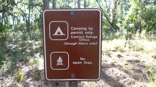
Established in 1931, the St. Marks National Wildlife Refuge located in the Florida panhandle region includes large swaths of pine forest, cypress swamps tidal pools and even a light house on the coast. The Florida Trail passes through the refuge and the only those that hike the refuge's entire length are allowed to camp but only at designated camp sites.
It was at the first of these that I had plans to meet with the group that evening. It was a simple plan and as long as they didn't move the trail there should be no problems.
Hey look, they moved the trail. And our first night's camp is directly in the center of the reroute. I hemmed and hawed for a while about what to do. Do I push on and hope they don't take the reroute, take the reroute and meet them at the next camp? With no way of reaching anyone on the hike and no idea if they were ahead or behind me I was already in a pickle on the first day. Finally I managed to get a hold of the another chapter member who was providing logistic support for the trip and based on her advice I decided to press on and hope they would meet me.
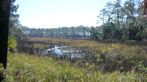
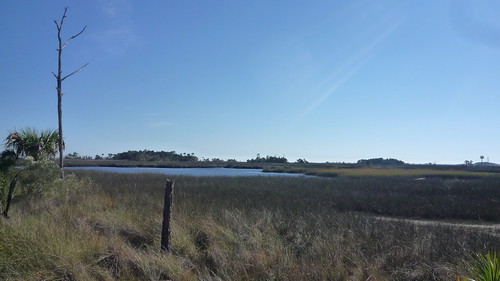
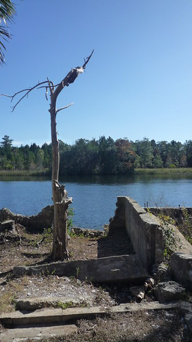
As the trail gets closer to the coast you begin to enter an area dominated by salt marshes. These tidal marshes are surrounded by palm trees and typically covered in wire grass which has a very sharp point. During the War Between the States this area was a large source of salt for the Confederacy and if you look you can usually find remains from the many salt works that existed here to support the war effort.
After setting up my WBBB at the Marsh Point campsite I set out to find some water. I had only brought a liter of water with me which proved to be a mistake as the trail had been very dry. Several of the listed water sources were little more than mud puddles and I ended up filtering about two liters from a small muddy pool I found about a mile from camp.
Fortunately by the time I got back the rest of the group had arrived and was in the process of setting up camp. I choose wisely to press on though that decision would prove to be questionable the next day.
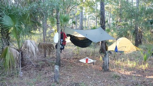
I was the only hanger in this group so the hammock generated a lot of interest. My setup for the trip was a WBBB & BMJ tarp for shelter and Hammock Gear for both top & bottom quilts. Even though the temp dropped into the mid 30s the hammock gear 40 deg TQ & UQ kept me cozy and warm. This is the first time I have camped with a hammock and I was happy with the results. I did have a couple of issues I need to address with my general setup though. The first is the Whoopieslings.com ridge line for the tarp. I really like it but found it was a bit short for some of the trees we have here in FL. I also had an issue keeping the WBBB foot box inside of the under quilt which made for some cold feet early in the morning. I am still working on finding the sweet spot for hanging with this setup but I have high hopes.
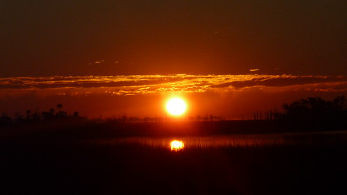
Saturday morning dawned clear and cold with a morning temp of around 35. I walked down to the salt marshes to watch the sun rise and got several good pictures. I also managed to scare up one of the many wild hogs that live in this area but I was too slow on the draw to get a picture before he went crashing off through the undergrowth.
I was without water and the rest of the group were still getting out of their tents by the time I had packed up so I elected to hike on ahead to the next water source and spring creek. The trail crisscrossed a dirt road several times and at one of these junctions I ran into a good old boy out for his morning walk. During the walk he explained that he owns a large tract of land next to the refuge they use for hunting. He also mentioned it was bow season in the area which made me happy I had my big red ULA catalyst pack on.
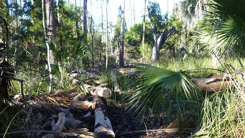
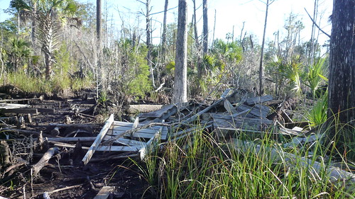
I asked him about all the downed trees I had seen and he explained that this was left over from a Hurricane that passed through this area a few years ago. He went on to say that most of this area had been under six feet of water and that several of the bridges on the trail had been destroyed. After about 20 minutes we parted ways with him heading back towards his land and me continuing on down the trail towards Spring Creek where I hoped to get water.
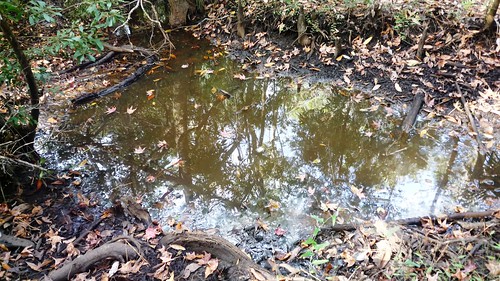
I had planned to get water at the creek and eat breakfast while I waited for the rest of the group but when I got there the creek was almost dry. What little bit of water was left in low spots turned out to be brackish and undrinkable. I sat for about twenty minutes on the bridge over the creek and ate my pop tart but still no sign of the group so I decided to press on in search of water. This is when the damage from the hurricane really started to become apparent.
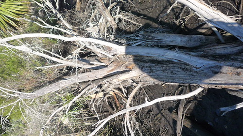
That last picture is where the problems started. That is the remains of the bridge that spanned a 500 yard area of soft thick mud. There was no way around it so I started to make my way across. There were sections where the mud was knee deep and my hiking polls would sink up to the handles. There was really no sign of the trail with all the markers having been blown down. I was forced to try and walk on logs that had fallen or jump from firm spot to firm spot but that would only get you so far before you had to step down into the mud. Often I would have to backtrack when there was no way across a really wet are. All in all it took me close to an hour to get across and through pure luck I came out right at an orange blaze.
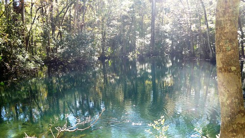
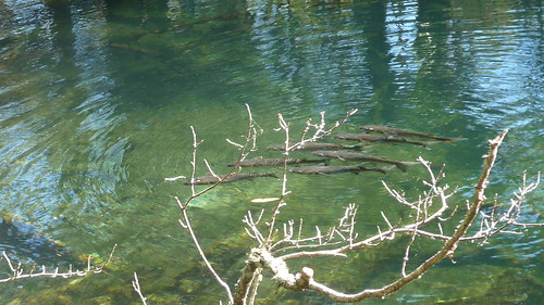
Cold, wet and tired I pressed on since I still had not found any drinkable water and I wouldn't find any for at least another four miles. So you can imagine how happy I was when I ran across this little pond. The water came out brown from tannin but it tasted oh so good. I took about a twenty minute break at this point and enjoyed the beautiful fall day.
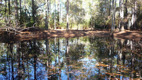
After that I hiked on another five miles stopping for an hour to eat lunch and let my feet air out. Then I finally made it to that night's designated camp area about 1:30. Still low on water I set up camp and hiked another mile down the trail to what turned out to be a very pretty spring. I rested for a bit and then lugged six liters of water back to camp to share with the group. They eventually arrived about two hours later and we swapped stories of the day as they set up camp.
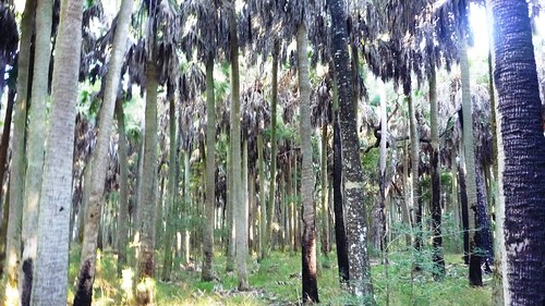
That night I slept like a rock but was up and out again before the rest of the group. Today's hike included a lot of road walking, both dirt and paved, but included on of the prettiest areas to me. This area is called the Cathedral of Palms and is comprised of several acres of palm trees. It was very peaceful walking through this area in the early morning with the sun shinning down through the tall palms.
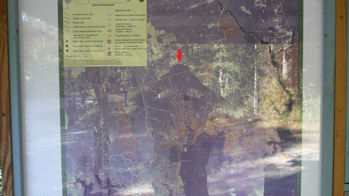
There are many roads leading into the refuge and they often have little information kiosks with maps and information on the surrounding area. I came across this one which showed your location with a big orange dot. To make it easier for you to see where I am I put in the red arrow.
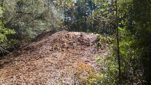
Around noon I was getting close to hwy 98 I passed a large sawdust mound that was close to 20 feet high. These saw dust mounds can be found throughout the area and are remnants from when this land was used for paper production. They would set up portable sawmills and harvest the timber. This is also evidenced by the perfect rows of pine trees that you see as you hike.
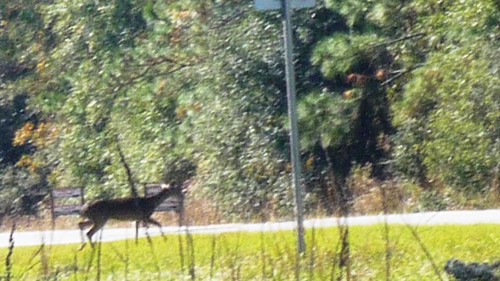
Just after the sawdust mound I came to HWY 98 near the bridge for the Wakulla River. As I stepped out of the woods onto the side of the road movement further down caught my eye and I froze. Two deer were less then twenty yards from me also trying to cross the highway. I slowly got my camera out and managed to get a couple of pictures as they crossed.
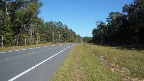
From here the trail crosses the Wakulla river and then runs along the highway for about three miles where it joins a rails to trails bike path that leads to the town of St. Marks. The hike was pretty uneventful at this point though I was slowed down by some blisters that had started to form after yesterday's mud slog. It took a couple of hours to make it to St. Marks not counting a quick stop at a convenience store for a coke and a Klondike bar. Right across the street from the store and directly on the trial is the local gun powder plant. Best to tread lightly when walking that part of the trail.
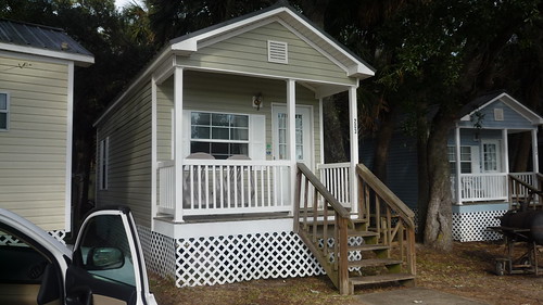
Once entering St. Marks I stopped and had a baccon cheesburger at the local dinner and then waited for my wife to show up. (late as usual) She and I were going to stay the night at the Shell Island Fish Camp in some small cottages they rent out. The trail crosses the St. Marks river and in one of the pictures you can see where it starts back up on the other side. The guide book says to "hail a boat" to get across. This is where I would have picked up Monday morning had I not started to feel sick.
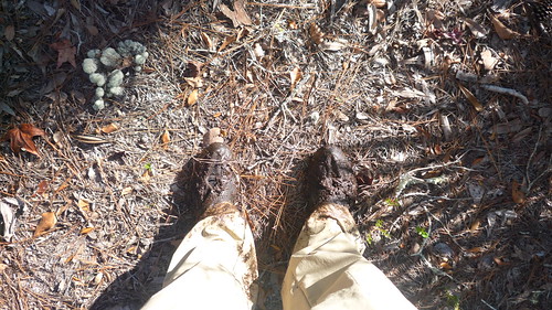
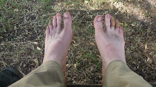
A picture of my sore tired dirty feet.
And a few shots of the fish camp and the cottage we stayed in.
As I mentioned I ended up cutting my trip short at this point. I had not been feeling well all day Sunday but I had written it off to being tired. As Sunday night turned into Monday morning it was becoming more and more apparent that I was starting to get sick so I decided to bow out. I said goodby to the group, packed my stuff in the car and headed home. Still, all in all, I had a great trip. I am already thinking about my next camping trip which will be the FL Hang in January and after that I am kicking around the idea of doing a few days on the AT in the spring.
Thanks,
--louis
PS: There are a lot more pictures up on my Flickr page: http://www.flickr.com/photos/louisfb...th/8182204560/


 Reply With Quote
Bookmarks