


Friday, June 5, 2009
I stepped off from the US-431 trailhead heading southwest on Friday afternoon. I had planned on hiking this section in March, but bronchitis forced me off at Porters Gap. I was now set to make up some or all of the miles I had left behind in March.
I was immediately glad I had chosen to wear lightweight long pants. Summer foliage was out.
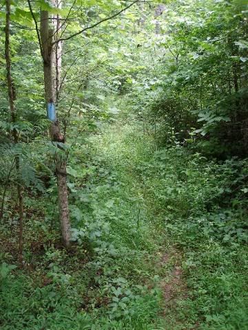
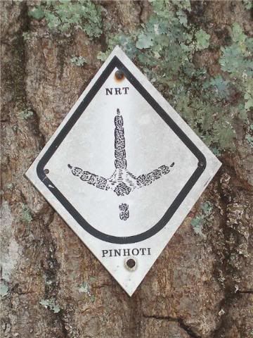
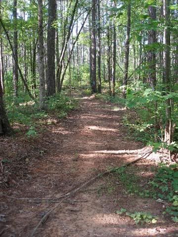
But the trail itself was still smooth and largely clear of blowdowns. I enjoyed not only the well-worn trail, clearly marked with blue blazes, but also the many older turkey track blazes of the early Pinhoti.
I made quick time up the mild hills, enjoying the stop at a gorgeous waterfall.
I pushed on, crossing CR-24 and heading on to Friendship Campsite. It was a nice spot where you could tuck away 4 or 5 tents easily. The creek was a clear water source that sang me to sleep quickly in the evening.
Saturday, June 6, 2009
Saturday dawned clear and noticeably warmer than the previous overcast day. By the time I had walked just three miles I was sweatier than I had been the previous day, despite the ease of the first mile of travel on an old smooth roadbed.
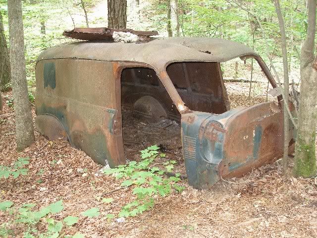
I continued moving along, enjoying water stops at creeks and streams, and stopping to check out an old truck hull that looked to have been left alongside the trail decades ago.
By the afternoon, the heat was kicking in as I began the 1200 foot climb to the main ridgeline adjoining Cheaha Mountain and State Park. I took my time, stopping for a few moments frequently and cooling off. I was happy to note that despite the heat and climbing, my lungs were doing fine. Still, despite drinking more than a gallon of water already this day, I was pushing sweat out of my body like a hydraulic pump.
When I reached the intersection to the Bald Rock Trail into Cheaha State Park, I knew I was done climbing for the day and close to home.
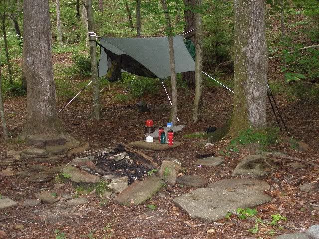
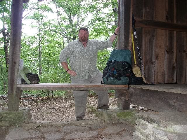
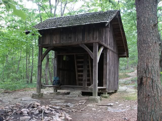
A ¼ mile later, I dropped my pack at Blue Mountain Shelter.
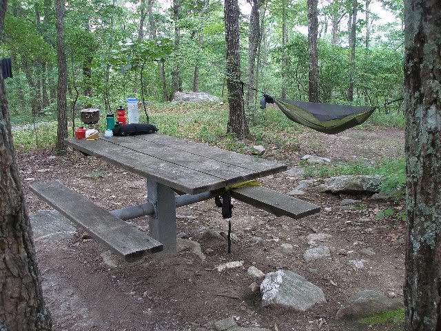
I headed back down the trail to gather water at the happily flowing spring and returned to set up my hammock near the shelter.
Graffiti and register entries mentioned the shelter was spooked, and that strange noises could be heard at night. It was another of many reasons I was glad to camp near the amenities of a shelter, while still enjoying the comfort of my hammock. Dinner was excellent (Chicken and stuffing with gravy) as I enjoyed a pleasant kitchen and dining room.
Due to the higher altitude, the evening cool sank below me and I slept a bit warm in my hammock, but still I enjoyed hearing hickory nuts drop to the ground and squirrels run about and I wondered if these accounted for some of the spooked noises as I drifted to sleep.
Sunday, June 7, 2009
This morning I had to make a choice. I had already set up a possible pick-up with my wife (she was staying with her parents who lived just a little over an hour away) at Cheaha State Park. Or I could continue on to Porters Gap another 29 miles up the trail.
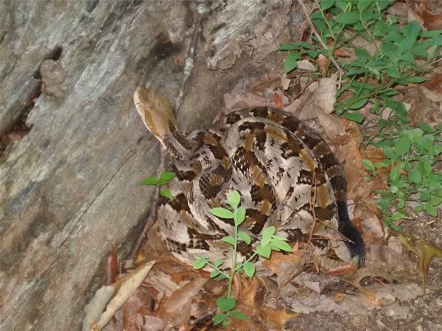
I stepped off, backtracking up to the Bald Rock Trail to enter the Park. I had already decided to blue blaze around the official Pinhoti Trail and walk through Cheaha State Park to see Bald Rock and stand on Cheaha Mountain, Alabamas high point, which the Pinhoti bypasses. I encountered a rattlesnake in the first few steps, still coiled and resting, which barely seemed to notice me.
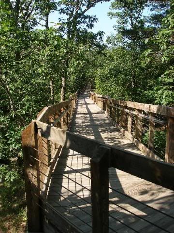
I headed up the ridge to Bald Rock. After a rocky climb, I was surprised to see a full boardwalk accessing the level ridgetop.
The view from Bald Rock was one the nicest I have seen any where in the south.
At this point, I decided to call my wife and join her at her parents. I wanted to share this view with her and decided that would bea much more pleasant way to spend the day than hiking the ridgeline in the ever-increasing heat and humidity.
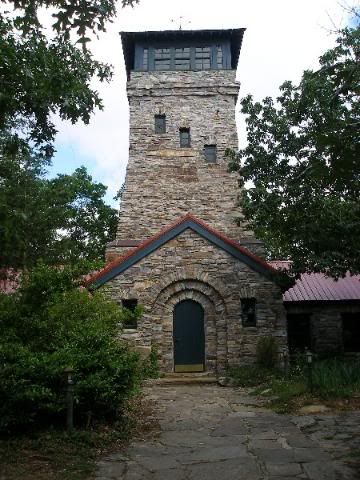
As I headed down from Bald Rock, I also stopped at the firetower on top of Cheaha Mountain. It is very similar to the one on top of Flagg Mountain, the official beginning of the Pinhoti trail 80 miles further southwest. Unlike the Flagg Mountain tower, it was unlocked to provide 360 views.
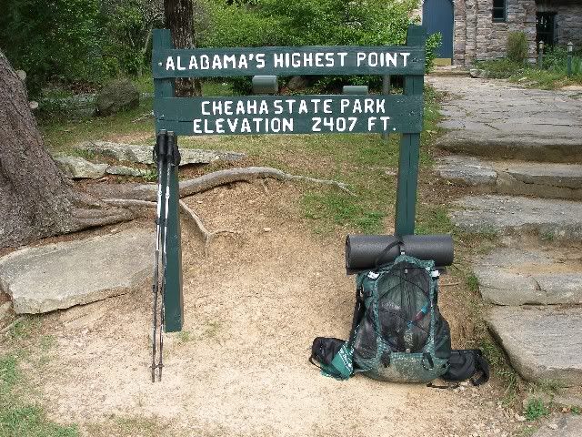
It is officially recognized as Alabamas high point.
From there I headed downhill to the camp store, where I grabbed a soda and waited for my ride home.


 Reply With Quote
Bookmarks