


After six days of dayhikes, an overnighter, and lots of great bike riding along the other trails of the Appalachian Trail corridor, I decided it was time for a full-on blue-blaze section hike. The route was obvious to me. I would hike blue-blaze trails in the open, cool, airy views of Grayson Highlands State Park, work my way past Mt. Rogers, and link up with the Virginia portion of the Iron Mountain Trail and hike it back into Damascus. For four days, I would enjoy some of the best of southwest Virginia and have it mostly to myself.
Monday, June 29, 2009
My wife dropped me off in GHSP at the parking lot just across from the Camp Store, saving me a climb up from Massey Gap. I headed up the pretty much flat and wide Wilson & Seed Orchard Road Trails toward the AT.
Once I hit the AT, I headed the 1/3 mile over to Wise Shelter to check it out for hang sites at next Januarys Mt. Rogers Hammock Hang.
After signing the register and having a snack, I backtracked the AT section and head up Wilson Creek Trail and joined the VA Highlands Horse Trail to the Scales.
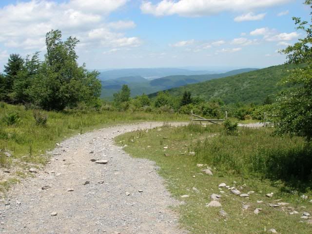
From here I took the Crest Trail west. Unlike the AT which occasionally opens up to the wide sweeping views of Grayson Highlands, the Crest Trail was open pretty much the entire time.
The air here at nearly 5000 feet was cool compared to the valleys and a solid wind kept everything even cooler. Still, the direct sun warmed my head a bit much where my visor was open, so I added a bandana and continued on.
I had not seen a single person on the trail to this point. But on the Crest I encountered two horseback riders. As the trail drew close to the Pine Mountain Trail which paralleled the Crest, I also spotted what appeared to be a student group playing hacky sack. I even ran into a small copperhead which quickly ran away. Compared to the earlier days hike, it was a swarm of others.
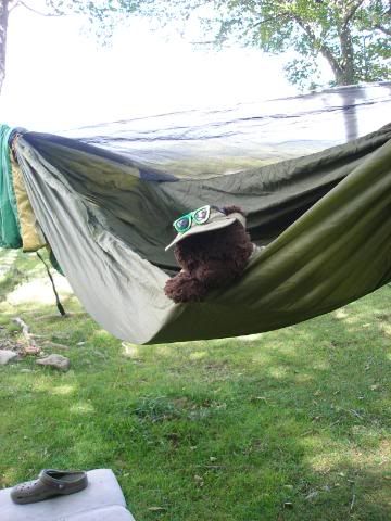
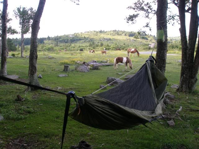
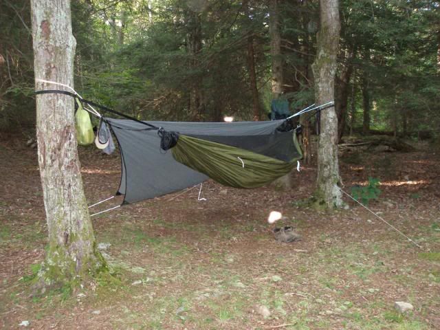
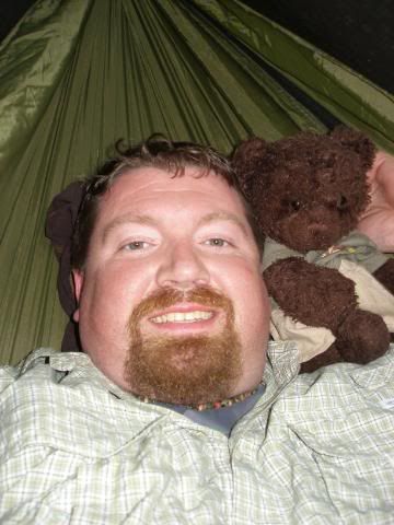
I had intended to push on and hang somewhere near Thomas Knob Shelter, but when I arrived at the intersection with the Lewis Fork and Pine Mountain Trails ( a couple of miles short of Thomas Knob), I found the most perfect campsite I could have imagined, a copse of trees with shade, level ground, and spacing perfect for hanging a hammock while enjoyed the 240 degree range of open views. I hung my hammock and Dewey Bear gave his approval.
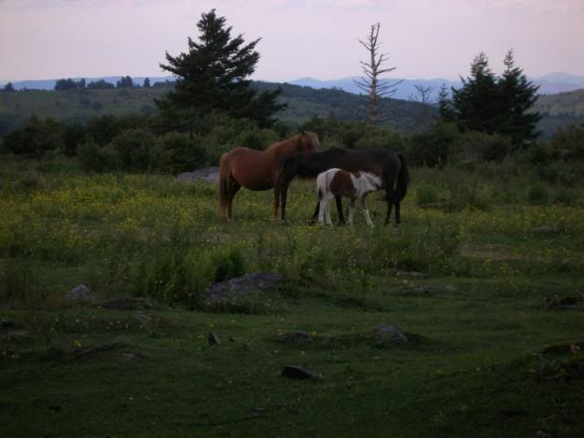
I walked up the 300 yards to the spring and found it a bit shallow, but I was still able to gather a gallon in about 15 minutes. When I returned, I took a nap. I awoke to a herd of 16 ponies enjoying dinner all around the campsite.
I cooked my own dinner and relaxed while the ponies chomped away. Afterward, I retired to my hammock. The gentle wind was enough to completely dispel any bugs, so I slept with the mesh top pulled back on my hammock. It was a great nights sleep.
Tuesday, June 30, 2009
The next morning, I packed up and headed on up the Crest Trail to Rhododendron Gap where I joined the much more enclosed Appalachian Trail.
I passed a couple of youth groups in large camps at a number of flat open site on the way to Thomas Knob. I also encountered a persistent pony blocking one of the stiles at a fence. I talked to him and eventually he eased away. Shortly after, I met a father and son and daughter who were excited to hear of ponies. They had stayed at Thomas Knob and had seen any of the wild horses yet.
Shortly afterward, I reached Thomas Knob Shelter.
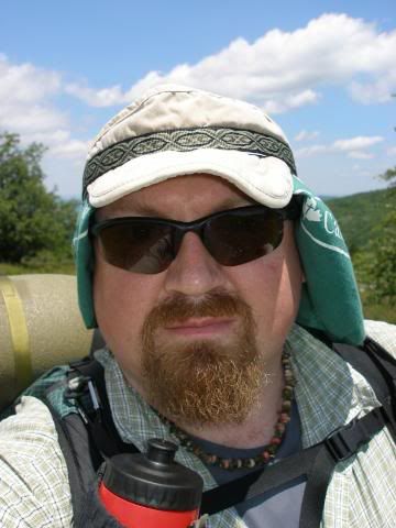
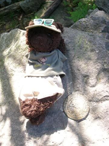
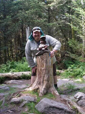
I signed the register and continued on to the Mt. Rogers Summit Trail. I had not climbed Virginias high point on my 1999 thru-hike. My high-mileage mindset had deterred me from wasting time and energy to climb up a mountain which offered no views. This time around, my 12-mile day easily allowed for such a jaunt. I hid my pack, added my camera, some water, and Dewey to my little Flash Pack, and I headed up the trail. I was really surprised how mellow the walk up was. It seemed virtually effortless. At the top, Dewey posed for a summit shot.
We then posed for one together.
Afterward, I encountered a coed group debating whether to climb to the summit at the AT intersection. They would be the last people I saw for the rest of my trip.
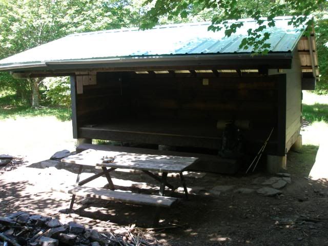
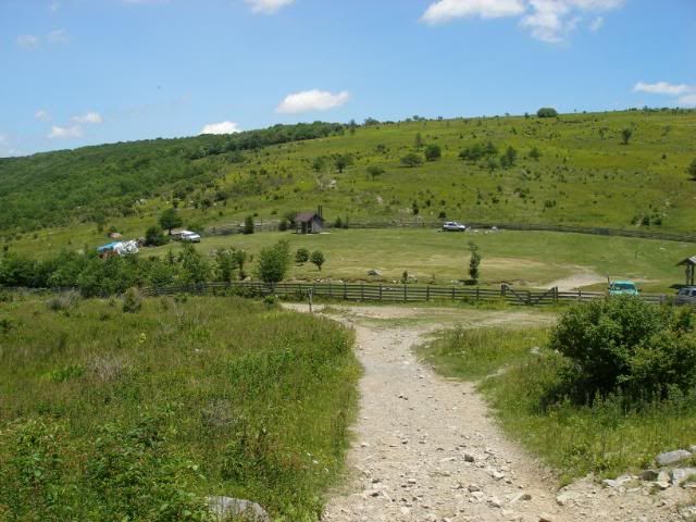
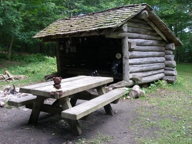
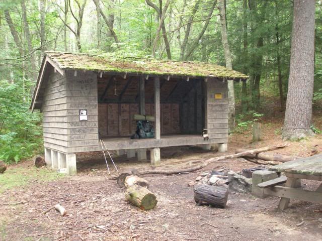
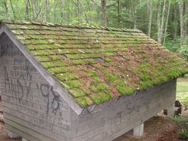
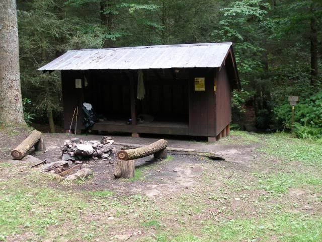
I headed around Mt. Rogers and took the Mt. Rogers Trail north, where it diverged from the AT. 4 miles and many switchbacks later, I crossed SR603 just east of Grindstone Campground. I quickly headed up the Flattop Trail. It was a bit of a grunt heading up the mix of dirt trail and gravel road, but I soon joined the Iron Mountain Trail at Cherry Tree Shelter, an older one made from all local unprocessed materials. The years of aging and moss give it the appearance of a thatched hut.
I gathered water from the deep spring, hung my hammock in a very nice site, and kicked back for a nap.
Afterward, I enjoyed dinner and relaxing with a book and my buddy before falling off to sleep.
Wednesday, July 1, 2009
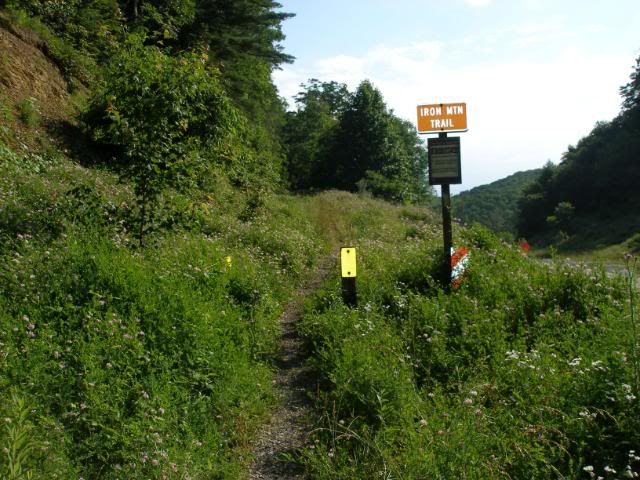
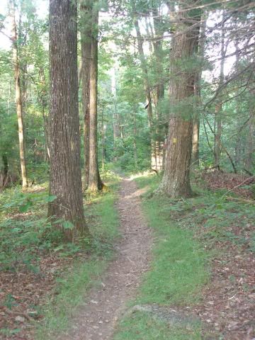
Imagine hiking the AT in good weather with almost complete solitude. Sounds impossible, right? The trick is to hike the OLD AT, the Virginia Iron Mountain Trail. Over its 24 miles, the IMT offers three shelters, excellent springs, gentle ridge line hiking, and best of all, very little or no human traffic.
I awoke from a rainy night of sleep and packed up. I was glad that the rain has stopped about half an hour before I was due to get up. I packed up in the shelter, just in case rain began to fall again from the overcast sky. I then headed out. Four miles later, I crossed SR600 at Skulls Gap.
I wasnt sure what to expect. This section all the way to Damascus is multi-use trail, open to horses, mountain bikes and even motorcycles. As soon as I stepped up from the trailhead, the mountain biker in me began to appreciate the possibilities of this prime piece of single track.
The mile to Straight Branch Shelter was easy and uneventful. Straight Branch Shelter had even more of a furry look than Cherry Tree did.
I enjoyed lunch and just as I was finishing, rain began to fall. I sat in the shelter, wondering how long it would last. About 3 minutes later, I had my answer when the rain stopped, and a bit of sunlight began to peek out.
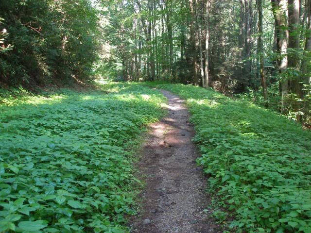
I packed up and headed the remaining five miles to Sandy Flats Shelter. The trail consisted of gentle ups and down mixed with long flat ridges most of the way. I arrived to find Sandy Flats a more modern shelter with a beautiful piped spring.
I hung my hammock and took yet another nap. The rhythm of the trail had set in.
Dinner followed, and then I finished my book in the evening as I drifted off to the excited Christmas Eve sensation I get at the end of a longer hike.
Thursday, July 2, 2009
I awoke at 4:30 AM. I tried to go back to sleep. And there was no chance. So I began packing, enjoyed a quick breakfast, and by 5:40, I was stepping off with a headlamp to fill in the trail tread as the day was just dawning.
After about 20 minutes, I was able to see well enough without the lamp. The trail was its usual mellow self, smooth and level. I made great time.
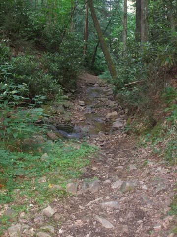
Five miles into the walk, I hit the spur trail 200 over to the Appalachian Trail. The registers in the shelters recommended taking the AT down to the Creeper Trail into Damascus. But this was a 3 ½ mile route, while the IMT was only 2.3 miles. Plus, I had hiked the AT/Creeper route before. And since I wanted to see the IMT, I chose to head down the supposedly rocky trail directly into Damascus.
It was a bit rocky, but not particularly bad. It barely slowed or changed my pace at all. Again, the mountain biker in me cheered as I appraised the quality of ride I could get from this section.
Just when I was getting excited at the prospect this bumpy downhill ride would give me, I reached road into Damascus. From the look of the map, I expected a gravel access road. Instead, it was a paved road running .6 miles through the suburbs of Damascus.
It was a perfectly mellow walk. Only a couple of dogs barked at me at 8:15 in the morning. It was a surprisingly happy way to end my blue blaze tour. I wondered how any one would know to come this way to hike out of Damascus on the IMT. As I approached the intersection of Douglas and 4th Street (you head north on 4th heading if walking out of town), I noticed the only clue, a couple of rough blue blazes on the edge of the road.
Whether they were meant to be a clue for any intrepid blue-blazers, or just survey marks meant little to me. They seemed the perfect conclusion to my 2009 Blue Blaze Tour.


 Reply With Quote


Bookmarks