I was at MAHHA last spring and kinda sorta remember the way things go.
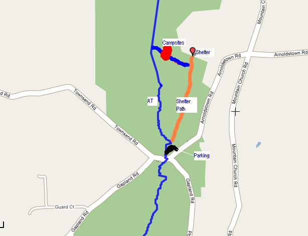
This map gives pretty much the same information that HC's map did, but without the X marks the spot part.
The parking area you see on this map is where you leave your vehicle.
The notable arch is in eyeshot, as is a picnic pavilion. There is a path
leading into the woods at the back side of the parking lot. If you are observant you'll see AT trail markers on a path that is to the west of the picnic pavilion, but the path you want is NOT the AT, it is the one out of the parking lot. So now you follow this a goodly ways, others have said about
a mile and that seems about right. Just before you come to a small spring
(and if memory serves maybe a wooden bridge over it), you have a chance to go up and left on a path that has a couple of switch backs in it. This path actually connects the spring and AT, (which at this point is a ways west and up from you.) In any case, chances are that qpens has been there before you and marked the trees with streamers leading the way. You'll emerge in a more or less open area where, depending on when you get there, you'll see a number of these hammocks strung up already. There are lots of good places to hang from there through a couple hundred yards southeast.
If you follow this path all the way up another hill and onto the AT you've gone too far!
Have a great time, wish I was going but instead I will be locked in in a conference room all day Friday.
Grizz


 Reply With Quote


Bookmarks