A simple map of the nationalpark
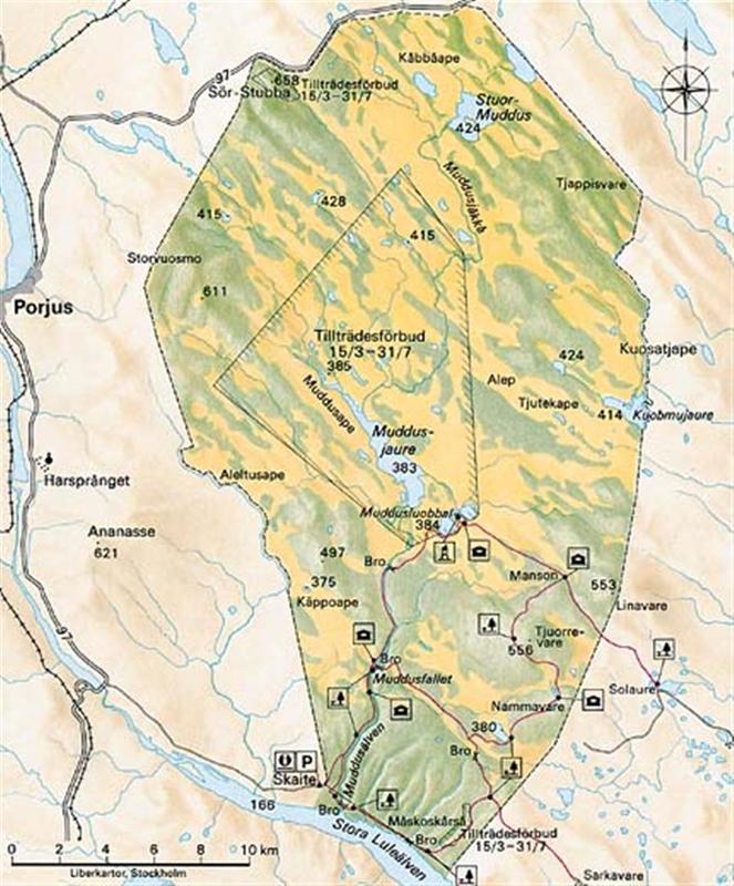
The trailsystem is in the south-east part of the park.
The shortest way to the waterfall is from the south (Skaite).
The shortest (and easiest) way to the complete trail is from the east (Solaure)
The trail is very easy to walk (except the part between Skaite and Muddusfallet)
When starting from Solaure, in the summer, we can go even further then to Solaure. There is a smaller road that takes us within 1km from the Muddus-border.
From that parkinglot to Manson it is only 4km
From Manson to Muddusluobbal it is 5km
From Muddusluobbal to Muddusfallet it is 9km
From Muddusfallet to Nammatesvare it is 11km
From Nammatesvare to the parkinglot (passing Manson) it is 11km
Totally 40km (easy trail)
If we hike that way, people with Alpackas could paddle from Muddusloubbal almost the hole stretch to Muddusfallet.


 Reply With Quote

Bookmarks